Area Overview for HU12 9SE
Photos of HU12 9SE
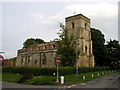
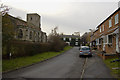
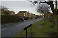
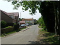
72 photos from this area
Area Information
Key information about the HU12 9SE including its size, population, and administrative classification.
- Area Type
- Postcode
- Area Size
- 6684 m²
- Population
- 1514
- Population Density
- 25 people/km²
House Prices in HU12 9SE
13
Properties
£119,375
Average Sold Price
£48,000
Lowest Price
£165,000
Highest Price
Showing 13 properties
| Address | Type | Beds | Baths | Last Sale Price | Last Sale Date | |
|---|---|---|---|---|---|---|
| 1 Griffiths Way, Keyingham, HU12 9SE | Detached | 3 | 1 | £100,000 | Sep 2021 | |
| 6 Griffiths Way, Keyingham, HU12 9SE | Bungalow | - | - | £138,000 | Jan 2018 | |
| 10 Griffiths Way, Keyingham, HU12 9SE | Bungalow | 3 | - | £130,000 | Dec 2015 | |
| 2 Griffiths Way, Keyingham, HU12 9SE | Bungalow | 3 | 1 | £110,000 | Dec 2014 | |
| The Lodge, Griffiths Way, Keyingham, HU12 9SE | Bungalow | 3 | - | £149,000 | Jun 2012 | |
| 3 Griffiths Way, Keyingham, HU12 9SE | house | - | - | £115,000 | Sep 2009 | |
| 9 Griffiths Way, Keyingham, HU12 9SE | Bungalow | 3 | 2 | £165,000 | Feb 2005 | |
| 11 Griffiths Way, Keyingham, HU12 9SE | Detached | - | - | £48,000 | Nov 1999 | |
| 7 Griffiths Way, Keyingham, HU12 9SE | Semi-detached | 3 | 1 | - | - | |
| 12 Griffiths Way, Keyingham, HU12 9SE | Bungalow | - | - | - | - |
Page 1 of 2
Energy Efficiency in HU12 9SE
Amenities
Schools
| Rank | School | Type | Entry gender | Ages |
|---|
Explore more schools in this area
Go to Schools tabDemographics
Household Size
Two person
most common
Accommodation Type
Houses
most common
Tenure
75
majority
Ethnic Group
White
most common
Religion
N/A
most common
Household Composition
N/A
most common
Age
47
median
Adults (30-64 years)
most common
Household Deprivation
N/A
with no deprivation
NS-SEC
31
in Lower managerial occupations
Explore more demographic insights in this area
Go to Demographics tabPlanning
Planning Constraints
- Flood RiskPremium
- Ramsar Wetland SitesPremium
- Area of Outstanding Natural BeautyPremium
- Protected Nature ReservePremium
- Protected WoodlandPremium