Area Overview for HU12 8FB
Photos of HU12 8FB
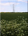
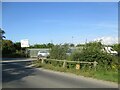
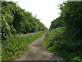
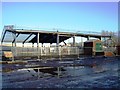
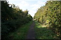
43 photos from this area
Area Information
Key information about the HU12 8FB including its size, population, and administrative classification.
- Area Type
- Postcode
- Area Size
- 40.7 hectares
- Population
- 1812
- Population Density
- 272 people/km²
House Prices in HU12 8FB
6
Properties
-
Average Sold Price
-
Lowest Price
-
Highest Price
Showing 6 properties
| Address | Type | Beds | Baths | Last Sale Price | Last Sale Date | |
|---|---|---|---|---|---|---|
| Wind Turbine 2 West Of The Limes, Staithes Road, Preston, HU12 8FB | Industrial | - | - | - | - | |
| Domestic Cabin, Spacemaker Cabins Limited, Staithes Road, Preston, HU12 8FB | Mobile Home | - | - | - | - | |
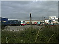
| Former Grp Building Solutions Limited Warehouse, Newfields Industrial Estate, Century Road, Saltend, HU12 8FB | storage_distribution | - | - | - | - | |
| Sjp Transport Limited, Unit 9, Newfields Industrial Estate, Century Road, Saltend, HU12 8FB | general_industrial | - | - | - | - | |
| Land And Building South Of Ferndale Park, Newfields Industrial Estate, Century Road, Saltend, HU12 8FB | warehouse | - | - | - | - | |
| Grp Building Solutions Limited, Grp Building Solutions Limited Office, Newfields Industrial Estate, Century Road, Saltend, HU12 8FB | Office | - | - | - | - |
Energy Efficiency in HU12 8FB
Amenities
Schools
| Rank | School | Type | Entry gender | Ages |
|---|
Explore more schools in this area
Go to Schools tabDemographics
Household Size
Family (3-5 people)
most common
Accommodation Type
Houses
most common
Tenure
77
majority
Ethnic Group
White
most common
Religion
N/A
most common
Household Composition
N/A
most common
Age
47
median
Adults (30-64 years)
most common
Household Deprivation
N/A
with no deprivation
NS-SEC
30
in Lower managerial occupations
Explore more demographic insights in this area
Go to Demographics tabPlanning
Planning Constraints
- Flood RiskPremium
- Ramsar Wetland SitesPremium
- Area of Outstanding Natural BeautyPremium
- Protected Nature ReservePremium
- Protected WoodlandPremium