Area Overview for HU12 0NE
Photos of HU12 0NE
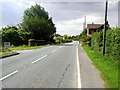
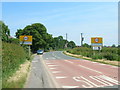
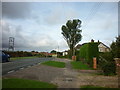
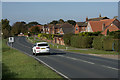
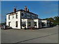
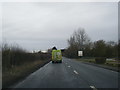
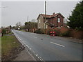
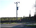
26 photos from this area
Area Information
Key information about the HU12 0NE including its size, population, and administrative classification.
- Area Type
- Postcode
- Area Size
- 62.2 hectares
- Population
- 1583
- Population Density
- 58 people/km²
House Prices in HU12 0NE
32
Properties
£209,553
Average Sold Price
£20,000
Lowest Price
£412,500
Highest Price
Showing 32 properties
| Address | Type | Beds | Baths | Last Sale Price | Last Sale Date | |
|---|---|---|---|---|---|---|
| St Annes, Station Road, Patrington, HU12 0NE | Detached | 4 | 1 | £350,000 | Oct 2024 | |
| 40 Station Road, Patrington, HU12 0NE | house | 3 | - | £249,000 | Sep 2022 | |
| Bliss Hill, 36A Station Road, Patrington, HU12 0NE | Detached | 5 | 4 | £412,500 | Mar 2022 | |
| Enholmes Lodge, Station Road, Patrington, HU12 0NE | house | - | - | £325,000 | Mar 2021 | |
| El Toril, 28 Station Road, Patrington, HU12 0NE | Detached | 4 | 2 | £230,000 | Oct 2019 | |
| 42 Station Road, Patrington, HU12 0NE | Semi-detached | 3 | - | £198,000 | May 2019 | |
| Swiss Cottage, Station Road, Patrington, HU12 0NE | Bungalow | 4 | 1 | £300,000 | Oct 2018 | |
| 1 Station Road, Patrington, HU12 0NE | Bungalow | 2 | - | £130,000 | Jul 2018 | |
| 36 Station Road, Patrington, HU12 0NE | Bungalow | - | - | £190,000 | Jan 2014 | |
| Field View, 44 Station Road, Patrington, HU12 0NE | house | - | - | £212,000 | May 2013 |
Page 1 of 4
Energy Efficiency in HU12 0NE
Amenities
Schools
| Rank | School | Type | Entry gender | Ages |
|---|
Explore more schools in this area
Go to Schools tabDemographics
Household Size
Two person
most common
Accommodation Type
Houses
most common
Tenure
83
majority
Ethnic Group
White
most common
Religion
N/A
most common
Household Composition
N/A
most common
Age
47
median
Adults (30-64 years)
most common
Household Deprivation
N/A
with no deprivation
NS-SEC
28
in Lower managerial occupations
Explore more demographic insights in this area
Go to Demographics tabPlanning
Planning Constraints
- Flood RiskPremium
- Ramsar Wetland SitesPremium
- Area of Outstanding Natural BeautyPremium
- Protected Nature ReservePremium
- Protected WoodlandPremium