Area Overview for HU11 5SG
Photos of HU11 5SG
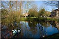
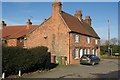
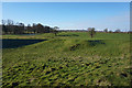
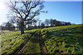
62 photos from this area
Area Information
Key information about the HU11 5SG including its size, population, and administrative classification.
- Area Type
- Postcode
- Area Size
- 1.6 hectares
- Population
- 2242
- Population Density
- 47 people/km²
House Prices in HU11 5SG
18
Properties
£119,006
Average Sold Price
£46,500
Lowest Price
£169,950
Highest Price
Showing 18 properties
| Address | Type | Beds | Baths | Last Sale Price | Last Sale Date | |
|---|---|---|---|---|---|---|
| 16 Back Lane, Seaton, HU11 5SG | house | - | - | £130,000 | Jul 2023 | |
| Sunshine Cottage, 9 Back Lane, Seaton, HU11 5SG | Cottage | 2 | 1 | £169,950 | Nov 2022 | |
| 1 Back Lane, Seaton, HU11 5SG | house | 2 | 1 | £91,650 | Oct 2022 | |
| 2 Back Lane, Seaton, HU11 5SG | house | - | - | £80,000 | Jun 2020 | |
| Marlans, Back Lane, Seaton, HU11 5SG | Detached | 2 | - | £159,950 | Jul 2018 | |
| Copperfields, 10 Back Lane, Seaton, HU11 5SG | Terraced | 2 | 2 | £125,000 | May 2008 | |
| Kilmorra, Back Lane, Seaton, HU11 5SG | Detached | - | - | £125,000 | Oct 2007 | |
| Raleigh Dene, Back Lane, Seaton, HU11 5SG | Semi-detached | - | - | £143,000 | May 2006 | |
| 12 Back Lane, Seaton, HU11 5SG | house | - | - | £46,500 | Dec 1998 | |
| Midway, Back Lane, Seaton, HU11 5SG | Cottage | 2 | 1 | - | - |
Page 1 of 2
Energy Efficiency in HU11 5SG
Amenities
Schools
| Rank | School | Type | Entry gender | Ages |
|---|
Explore more schools in this area
Go to Schools tabDemographics
Household Size
Two person
most common
Accommodation Type
Houses
most common
Tenure
76
majority
Ethnic Group
White
most common
Religion
N/A
most common
Household Composition
N/A
most common
Age
47
median
Adults (30-64 years)
most common
Household Deprivation
N/A
with no deprivation
NS-SEC
32
in Lower managerial occupations
Explore more demographic insights in this area
Go to Demographics tabPlanning
Planning Constraints
- Flood RiskPremium
- Ramsar Wetland SitesPremium
- Area of Outstanding Natural BeautyPremium
- Protected Nature ReservePremium
- Protected WoodlandPremium