Area Overview for HU11 5SE
Photos of HU11 5SE
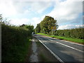
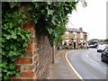
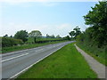
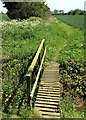
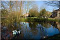
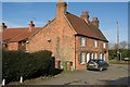
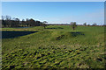
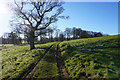
62 photos from this area
Area Information
Key information about the HU11 5SE including its size, population, and administrative classification.
- Area Type
- Postcode
- Area Size
- 7643 m²
- Population
- 2242
- Population Density
- 47 people/km²
House Prices in HU11 5SE
18
Properties
£108,916
Average Sold Price
£15,162
Lowest Price
£273,000
Highest Price
Showing 18 properties
| Address | Type | Beds | Baths | Last Sale Price | Last Sale Date | |
|---|---|---|---|---|---|---|
| 5 Middle Lane, Seaton, HU11 5SE | Detached | 3 | 1 | £158,000 | Sep 2023 | |
| May Rose Cottage, 6 Middle Lane, Seaton, HU11 5SE | Terraced | 2 | 1 | £125,000 | Jan 2023 | |
| Eastlea, 4 Middle Lane, Seaton, HU11 5SE | Terraced | 2 | 1 | £105,000 | Aug 2022 | |
| The Villa, 20 Middle Lane, Seaton, HU11 5SE | house | - | - | £273,000 | Apr 2018 | |
| Glenholm, 12 Middle Lane, Seaton, HU11 5SE | house | - | - | £75,000 | Apr 2015 | |
| Tawny Hoots Cottage, 10 Middle Lane, Seaton, HU11 5SE | Cottage | 2 | 1 | £94,000 | Sep 2007 | |
| 15 Middle Lane, Seaton, HU11 5SE | house | - | - | £98,000 | Jan 2007 | |
| 3 Middle Lane, Seaton, HU11 5SE | house | - | - | £109,995 | Sep 2006 | |
| 1 Middle Lane, Seaton, HU11 5SE | Terraced | - | - | £15,162 | Mar 2002 | |
| 11 Middle Lane, Seaton, HU11 5SE | Terraced | - | - | £36,000 | Nov 1995 |
Page 1 of 2
Energy Efficiency in HU11 5SE
Amenities
Schools
| Rank | School | Type | Entry gender | Ages |
|---|
Explore more schools in this area
Go to Schools tabDemographics
Household Size
Two person
most common
Accommodation Type
Houses
most common
Tenure
76
majority
Ethnic Group
White
most common
Religion
N/A
most common
Household Composition
N/A
most common
Age
47
median
Adults (30-64 years)
most common
Household Deprivation
N/A
with no deprivation
NS-SEC
32
in Lower managerial occupations
Explore more demographic insights in this area
Go to Demographics tabPlanning
Planning Constraints
- Flood RiskPremium
- Ramsar Wetland SitesPremium
- Area of Outstanding Natural BeautyPremium
- Protected Nature ReservePremium
- Protected WoodlandPremium