Area Overview for HU10 7PH
Photos of HU10 7PH
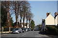
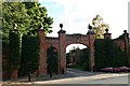
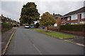
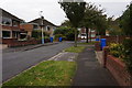
41 photos from this area
Area Information
Key information about the HU10 7PH including its size, population, and administrative classification.
- Area Type
- Postcode
- Area Size
- 1.7 hectares
- Population
- 1470
- Population Density
- 2819 people/km²
House Prices in HU10 7PH
23
Properties
£257,282
Average Sold Price
£85,750
Lowest Price
£590,000
Highest Price
Showing 23 properties
| Address | Type | Beds | Baths | Last Sale Price | Last Sale Date | |
|---|---|---|---|---|---|---|
| 1 Westland Road, Kirk Ella, HU10 7PH | house | 4 | - | £391,000 | Feb 2023 | |
| 35 Westland Road, Kirk Ella, HU10 7PH | house | - | - | £392,000 | Jul 2022 | |
| Andora, 9 Westland Road, Kirk Ella, HU10 7PH | house | - | - | £590,000 | Oct 2019 | |
| 29 Westland Road, Kirk Ella, HU10 7PH | Semi-detached | 3 | 1 | £315,000 | Aug 2019 | |
| 27 Westland Road, Kirk Ella, HU10 7PH | Semi-detached | 5 | 2 | £290,000 | Feb 2019 | |
| 7 Westland Road, Kirk Ella, HU10 7PH | house | - | - | £287,000 | Dec 2018 | |
| 5 Westland Road, Kirk Ella, HU10 7PH | house | 3 | 2 | £300,000 | Jul 2018 | |
| 17 Westland Road, Kirk Ella, HU10 7PH | Semi-detached | - | - | £201,250 | Jun 2006 | |
| 3 Westland Road, Kirk Ella, HU10 7PH | Semi-detached | - | - | £210,000 | Dec 2005 | |
| 33 Westland Road, Kirk Ella, HU10 7PH | Semi-detached | - | - | £219,500 | Jan 2005 |
Page 1 of 3
Energy Efficiency in HU10 7PH
Amenities
Schools
| Rank | School | Type | Entry gender | Ages |
|---|
Explore more schools in this area
Go to Schools tabDemographics
Household Size
Two person
most common
Accommodation Type
Houses
most common
Tenure
92
majority
Ethnic Group
White
most common
Religion
N/A
most common
Household Composition
N/A
most common
Age
47
median
Adults (30-64 years)
most common
Household Deprivation
N/A
with no deprivation
NS-SEC
45
in Lower managerial occupations
Explore more demographic insights in this area
Go to Demographics tabPlanning
Planning Constraints
- Flood RiskPremium
- Ramsar Wetland SitesPremium
- Area of Outstanding Natural BeautyPremium
- Protected Nature ReservePremium
- Protected WoodlandPremium