Area Overview for HU10 7DP
Photos of HU10 7DP
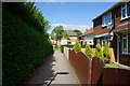
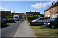
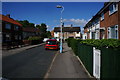
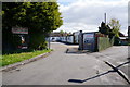
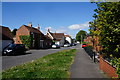
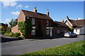
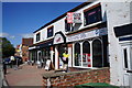
83 photos from this area
Area Information
Key information about the HU10 7DP including its size, population, and administrative classification.
- Area Type
- Postcode
- Area Size
- 2.1 hectares
- Population
- 1423
- Population Density
- 3784 people/km²
House Prices in HU10 7DP
34
Properties
£225,742
Average Sold Price
£76,500
Lowest Price
£389,000
Highest Price
Showing 34 properties
| Address | Type | Beds | Baths | Last Sale Price | Last Sale Date | |
|---|---|---|---|---|---|---|
| 17 Lynwood Avenue, Anlaby, HU10 7DP | Detached | 4 | 1 | £389,000 | Jun 2021 | |
| 32 Lynwood Avenue, Anlaby, HU10 7DP | house | - | - | £315,890 | Jun 2021 | |
| 15 Lynwood Avenue, Anlaby, HU10 7DP | house | - | - | £385,000 | Feb 2021 | |
| 2 Lynwood Avenue, Anlaby, HU10 7DP | house | - | - | £318,000 | Jan 2021 | |
| 1 Lynwood Avenue, Anlaby, HU10 7DP | Semi-detached | 3 | - | £375,000 | Nov 2019 | |
| 11 Lynwood Avenue, Anlaby, HU10 7DP | Semi-detached | 5 | 3 | £345,000 | Oct 2019 | |
| 30 Lynwood Avenue, Anlaby, HU10 7DP | house | - | - | £228,000 | Apr 2019 | |
| 21 Lynwood Avenue, Anlaby, HU10 7DP | Bungalow | 3 | 1 | £297,500 | Jan 2018 | |
| 25 Lynwood Avenue, Anlaby, HU10 7DP | Semi-detached | 2 | 1 | £182,000 | Nov 2017 | |
| 7 Lynwood Avenue, Anlaby, HU10 7DP | house | - | - | £329,500 | Nov 2016 |
Page 1 of 4
Energy Efficiency in HU10 7DP
Amenities
Schools
| Rank | School | Type | Entry gender | Ages |
|---|
Explore more schools in this area
Go to Schools tabDemographics
Household Size
Two person
most common
Accommodation Type
Houses
most common
Tenure
69
majority
Ethnic Group
White
most common
Religion
N/A
most common
Household Composition
N/A
most common
Age
47
median
Adults (30-64 years)
most common
Household Deprivation
N/A
with no deprivation
NS-SEC
30
in Lower managerial occupations
Explore more demographic insights in this area
Go to Demographics tabPlanning
Planning Constraints
- Flood RiskPremium
- Ramsar Wetland SitesPremium
- Area of Outstanding Natural BeautyPremium
- Protected Nature ReservePremium
- Protected WoodlandPremium