Area Overview for HU10 7AL
Photos of HU10 7AL
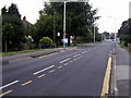
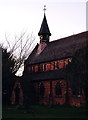
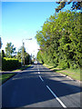
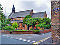
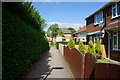
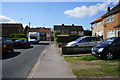
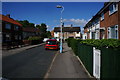
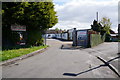
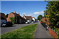
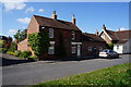
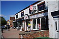
83 photos from this area
Area Information
Key information about the HU10 7AL including its size, population, and administrative classification.
- Area Type
- Postcode
- Area Size
- 8159 m²
- Population
- 1423
- Population Density
- 3784 people/km²
House Prices in HU10 7AL
17
Properties
£220,973
Average Sold Price
£89,000
Lowest Price
£325,000
Highest Price
Showing 17 properties
| Address | Type | Beds | Baths | Last Sale Price | Last Sale Date | |
|---|---|---|---|---|---|---|
| 58 Wilson Street, Anlaby, HU10 7AL | Semi-detached | 3 | 1 | £250,000 | Nov 2022 | |
| 31 Wilson Street, Anlaby, HU10 7AL | Detached | 3 | 2 | £325,000 | Oct 2020 | |
| 37 Wilson Street, Anlaby, HU10 7AL | Semi-detached | 4 | 1 | £295,000 | Jan 2019 | |
| 35 Wilson Street, Anlaby, HU10 7AL | house | - | - | £241,280 | Dec 2017 | |
| 62 Wilson Street, Anlaby, HU10 7AL | Detached | 4 | 1 | £300,000 | Apr 2016 | |
| 47 Wilson Street, Anlaby, HU10 7AL | Semi-detached | 4 | 2 | £225,000 | Dec 2012 | |
| 54 Wilson Street, Anlaby, HU10 7AL | Semi-detached | - | - | £165,000 | Oct 2008 | |
| 39 Wilson Street, Anlaby, HU10 7AL | Semi-detached | - | - | £212,500 | Apr 2008 | |
| 56 Wilson Street, Anlaby, HU10 7AL | Semi-detached | - | - | £89,000 | Jun 2001 | |
| 45 Wilson Street, Anlaby, HU10 7AL | Semi-detached | - | - | £106,950 | Aug 2000 |
Page 1 of 2
Energy Efficiency in HU10 7AL
Amenities
Schools
| Rank | School | Type | Entry gender | Ages |
|---|
Explore more schools in this area
Go to Schools tabDemographics
Household Size
Two person
most common
Accommodation Type
Houses
most common
Tenure
69
majority
Ethnic Group
White
most common
Religion
N/A
most common
Household Composition
N/A
most common
Age
47
median
Adults (30-64 years)
most common
Household Deprivation
N/A
with no deprivation
NS-SEC
30
in Lower managerial occupations
Explore more demographic insights in this area
Go to Demographics tabPlanning
Planning Constraints
- Flood RiskPremium
- Ramsar Wetland SitesPremium
- Area of Outstanding Natural BeautyPremium
- Protected Nature ReservePremium
- Protected WoodlandPremium