Area Overview for HD9 2QH
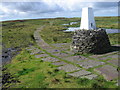
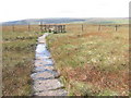
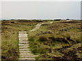
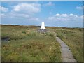
Photos of HD9 2QH


Area Information
HD9 2QH is a small, tightly knit residential postcode area in England, spanning 11.7 km² with a population of 1,664 people. Its low population density of 57 people per km² suggests a quiet, less congested environment, ideal for those seeking space without urban sprawl. The area’s compact size means residents are likely close to local amenities, schools, and transport links. With a median age of 47 and a majority of residents aged 30–64, it caters to established families and professionals. The high home ownership rate of 79% indicates a stable, long-term community, with most properties being houses rather than flats. This makes HD9 2QH a place where neighbours are likely to know each other, and daily life revolves around local shops, schools, and rail stations. While the area lacks major landmarks or commercial hubs, its proximity to nearby towns via rail and its low crime risk make it appealing for buyers prioritising safety and a slower pace of life.
- Area Type
- Postcode
- Area Size
- 11.7 km²
- Population
- 1664
- Population Density
- 57 people/km²
HD9 2QH is a predominantly owner-occupied area, with 79% of residents living in homes they own. The accommodation type is houses, which is typical for smaller, suburban postcode areas. This suggests a housing stock that is largely family-friendly, with properties likely designed for long-term occupancy rather than short-term rentals. The small size of the area—just 11.7 km²—means the number of available homes is limited, potentially making the market competitive for buyers. With a high home ownership rate, the area is not a rental hotspot, and property values may reflect the demand for stable, private living. Buyers should consider that the housing stock is unlikely to expand significantly, given the area’s compact size and existing infrastructure. Those seeking a home here may find a mix of older and newer properties, but the market is likely to prioritise existing homes over new developments.
House Prices in HD9 2QH
No properties found in this postcode.
Energy Efficiency in HD9 2QH
The lifestyle in HD9 2QH is shaped by its proximity to retail and transport hubs. Nearby shops include Co-op Meltham, Morrisons Meltham, and Co-op Marsden, offering everyday essentials and grocery needs. These stores are likely within walking or short driving distance, supporting a convenient, localised shopping experience. The area’s rail stations—Marsden, Greenfield, and Slaithwaite—provide access to nearby towns, enhancing connectivity for leisure, work, or social activities. While the data does not mention parks or recreational spaces, the presence of retail and rail amenities suggests a balance between practicality and accessibility. The small size of the area means residents are close to both daily necessities and transport links, though larger leisure facilities may require travel to nearby towns.
Amenities
Schools
Residents of HD9 2QH have access to two primary schools within practical reach: Hinchliffe Mill Junior and Infant School and Holme Junior and Infant School. Both institutions hold a ‘good’ Ofsted rating, indicating a reliable standard of education for younger children. The presence of two primary schools suggests a focus on early education, though the data does not mention secondary schools or higher education options. For families with young children, this proximity to schools is a key advantage, reducing the need for long commutes. However, those requiring secondary education may need to look beyond the immediate area. The mix of schools here is limited to primary levels, so buyers should consider whether this aligns with their long-term educational needs.
| Rank | School | Type | Entry gender | Ages |
|---|
Explore more schools in this area
Go to Schools tabDemographics
The population of HD9 2QH is predominantly adults aged 30–64, with a median age of 47. This suggests a mature, settled community with fewer young families or retirees compared to other areas. Home ownership is high at 79%, indicating most residents live in properties they own rather than rent. The accommodation type is primarily houses, which aligns with the area’s low density and suburban character. The predominant ethnic group is White, reflecting a homogenous demographic profile. With 1,664 residents spread over 11.7 km², the area is not densely populated, which may contribute to a quieter, more private lifestyle. However, the data does not specify deprivation levels, so it is unclear how this affects access to services or quality of life. The age profile suggests a community focused on stability, with limited turnover in housing stock.
Household Size
Accommodation Type
Tenure
Ethnic Group
Religion
Household Composition
Age
Household Deprivation
NS-SEC
Explore more demographic insights in this area
Go to Demographics tabPlanning
Planning Constraints
- Flood RiskPremium
- Ramsar Wetland SitesPremium
- Area of Outstanding Natural BeautyPremium
- Protected Nature ReservePremium
- Protected WoodlandPremium