Area Overview for HD4 6UL
Photos of HD4 6UL
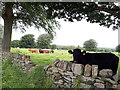
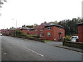

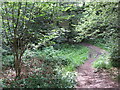
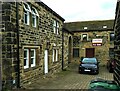
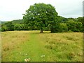
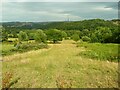
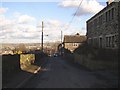
44 photos from this area
Area Information
Key information about the HD4 6UL including its size, population, and administrative classification.
- Area Type
- Postcode
- Area Size
- 63.4 hectares
- Population
- 1746
- Population Density
- 195 people/km²
House Prices in HD4 6UL
43
Properties
£483,957
Average Sold Price
£24,000
Lowest Price
£1,425,000
Highest Price
Showing 43 properties
| Address | Type | Beds | Baths | Last Sale Price | Last Sale Date | |
|---|---|---|---|---|---|---|
| 29 Manor Road, Farnley Tyas, Huddersfield, HD4 6UL | Cottage | 3 | 3 | £615,000 | Dec 2021 | |
| Meadow Barn, 16 Manor Road, Farnley Tyas, Huddersfield, HD4 6UL | Detached | 4 | 4 | £892,500 | Jun 2021 | |
| Field House, 24A Manor Road, Farnley Tyas, Huddersfield, HD4 6UL | house | - | - | £1,425,000 | Oct 2020 | |
| 12 Manor Road, Farnley Tyas, Huddersfield, HD4 6UL | Detached | 5 | - | £580,000 | Dec 2019 | |
| Croft House Farm, 24 Manor Road, Farnley Tyas, Huddersfield, HD4 6UL | house | - | - | £600,000 | Aug 2019 | |
| The Stables, 16A Manor Road, Farnley Tyas, Huddersfield, HD4 6UL | house | - | - | £820,000 | Jun 2019 | |
| 14 Manor Road, Farnley Tyas, Huddersfield, HD4 6UL | house | - | - | £575,000 | Jun 2019 | |
| Manor Farm House, 26 Manor Road, Farnley Tyas, Huddersfield, HD4 6UL | house | - | - | £600,000 | Jul 2017 | |
| Netherton Farm, 41 Manor Road, Farnley Tyas, Huddersfield, HD4 6UL | Detached | 5 | 2 | £506,500 | Dec 2016 | |
| Meadow Cottage, 38 Manor Road, Farnley Tyas, Huddersfield, HD4 6UL | house | - | - | £408,000 | Jul 2016 |
Page 1 of 5
Energy Efficiency in HD4 6UL
Amenities
Schools
| Rank | School | Type | Entry gender | Ages |
|---|
Explore more schools in this area
Go to Schools tabDemographics
Household Size
Two person
most common
Accommodation Type
Houses
most common
Tenure
85
majority
Ethnic Group
White
most common
Religion
N/A
most common
Household Composition
N/A
most common
Age
22
median
Young Adults (15-29 years)
most common
Household Deprivation
N/A
with no deprivation
NS-SEC
30
in Lower managerial occupations
Explore more demographic insights in this area
Go to Demographics tabPlanning
Planning Constraints
- Flood RiskPremium
- Ramsar Wetland SitesPremium
- Area of Outstanding Natural BeautyPremium
- Protected Nature ReservePremium
- Protected WoodlandPremium