Area Overview for HD8 0PT
Photos of HD8 0PT
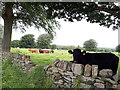
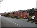

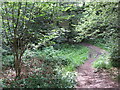
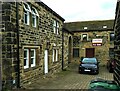
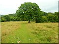
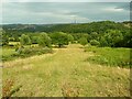
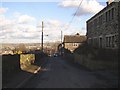
44 photos from this area
Area Information
Key information about the HD8 0PT including its size, population, and administrative classification.
- Area Type
- Postcode
- Area Size
- 79.1 hectares
- Population
- 1746
- Population Density
- 195 people/km²
House Prices in HD8 0PT
33
Properties
£200,973
Average Sold Price
£69,950
Lowest Price
£724,000
Highest Price
Showing 33 properties
| Address | Type | Beds | Baths | Last Sale Price | Last Sale Date | |
|---|---|---|---|---|---|---|
| 68 Storthes Hall Lane, Kirkburton, Huddersfield, HD8 0PT | house | 3 | 1 | £285,000 | Sep 2025 | |
| 46 Storthes Hall Lane, Kirkburton, Huddersfield, HD8 0PT | house | - | - | £285,000 | Aug 2024 | |
| 43 Storthes Hall Lane, Kirkburton, Huddersfield, HD8 0PT | Semi-detached | 3 | 2 | £322,000 | Aug 2023 | |
| 49 Storthes Hall Lane, Kirkburton, Huddersfield, HD8 0PT | Semi-detached | 3 | 2 | £222,500 | Jul 2023 | |
| Moorside House, Storthes Hall Lane, Kirkburton, Huddersfield, HD8 0PT | Detached | 4 | 2 | £724,000 | Jan 2023 | |
| 59 Storthes Hall Lane, Kirkburton, Huddersfield, HD8 0PT | house | - | - | £196,000 | Aug 2021 | |
| 65 STORTHES HALL LANE, Kirkburton, Huddersfield, HD8 0PT | Detached | - | - | £135,000 | Apr 2021 | |
| 58 Storthes Hall Lane, Kirkburton, Huddersfield, HD8 0PT | house | - | - | £149,000 | Feb 2021 | |
| 62 Storthes Hall Lane, Kirkburton, Huddersfield, HD8 0PT | house | 5 | - | £190,000 | Feb 2020 | |
| 41 Storthes Hall Lane, Kirkburton, Huddersfield, HD8 0PT | Semi-detached | 3 | 2 | £190,000 | May 2018 |
Page 1 of 4
Energy Efficiency in HD8 0PT
Amenities
Schools
| Rank | School | Type | Entry gender | Ages |
|---|
Explore more schools in this area
Go to Schools tabDemographics
Household Size
Two person
most common
Accommodation Type
Houses
most common
Tenure
85
majority
Ethnic Group
White
most common
Religion
N/A
most common
Household Composition
N/A
most common
Age
22
median
Young Adults (15-29 years)
most common
Household Deprivation
N/A
with no deprivation
NS-SEC
30
in Lower managerial occupations
Explore more demographic insights in this area
Go to Demographics tabPlanning
Planning Constraints
- Flood RiskPremium
- Ramsar Wetland SitesPremium
- Area of Outstanding Natural BeautyPremium
- Protected Nature ReservePremium
- Protected WoodlandPremium