Area Overview for HD4 5TA
Photos of HD4 5TA
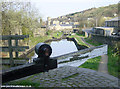


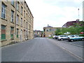
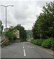
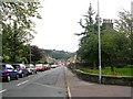
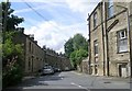
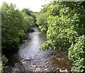

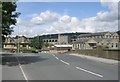
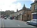
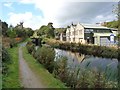
100 photos from this area
Area Information
Key information about the HD4 5TA including its size, population, and administrative classification.
- Area Type
- Postcode
- Area Size
- 7847 m²
- Population
- 1690
- Population Density
- 4088 people/km²
House Prices in HD4 5TA
36
Properties
£93,623
Average Sold Price
£36,250
Lowest Price
£177,000
Highest Price
Showing 36 properties
| Address | Type | Beds | Baths | Last Sale Price | Last Sale Date | |
|---|---|---|---|---|---|---|
| 963 Manchester Road, Milnsbridge, Huddersfield, HD4 5TA | Terraced | 3 | 1 | £177,000 | Dec 2024 | |
| 979 Manchester Road, Milnsbridge, Huddersfield, HD4 5TA | Terraced | 3 | 1 | £141,000 | Jul 2023 | |
| 991 Manchester Road, Milnsbridge, Huddersfield, HD4 5TA | Retail | 3 | 1 | £138,000 | Oct 2022 | |
| 971 Manchester Road, Milnsbridge, Huddersfield, HD4 5TA | Terraced | 3 | 1 | £80,000 | Jun 2022 | |
| 937 Manchester Road, Milnsbridge, Huddersfield, HD4 5TA | house | - | - | £93,500 | Nov 2021 | |
| 939 Manchester Road, Milnsbridge, Huddersfield, HD4 5TA | Terraced | 3 | 1 | £104,000 | May 2021 | |
| 927 Manchester Road, Milnsbridge, Huddersfield, HD4 5TA | Terraced | 2 | 1 | £83,000 | Jul 2018 | |
| 983 Manchester Road, Milnsbridge, Huddersfield, HD4 5TA | house | - | - | £81,000 | Aug 2016 | |
| 933 Manchester Road, Milnsbridge, Huddersfield, HD4 5TA | Terraced | 1 | 1 | £70,000 | Sep 2015 | |
| 973 Manchester Road, Milnsbridge, Huddersfield, HD4 5TA | Terraced | 3 | 1 | £80,000 | Sep 2013 |
Page 1 of 4
Energy Efficiency in HD4 5TA
Amenities
Schools
| Rank | School | Type | Entry gender | Ages |
|---|
Explore more schools in this area
Go to Schools tabDemographics
Household Size
One person
most common
Accommodation Type
Houses
most common
Tenure
67
majority
Ethnic Group
White
most common
Religion
N/A
most common
Household Composition
N/A
most common
Age
47
median
Adults (30-64 years)
most common
Household Deprivation
N/A
with no deprivation
NS-SEC
25
in Lower managerial occupations
Explore more demographic insights in this area
Go to Demographics tabPlanning
Planning Constraints
- Flood RiskPremium
- Ramsar Wetland SitesPremium
- Area of Outstanding Natural BeautyPremium
- Protected Nature ReservePremium
- Protected WoodlandPremium