Area Overview for HD4 5SH
Photos of HD4 5SH
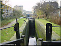
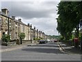
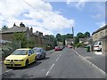
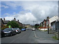

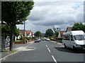
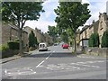
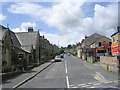

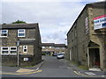
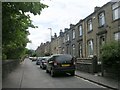
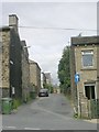
100 photos from this area
Area Information
Key information about the HD4 5SH including its size, population, and administrative classification.
- Area Type
- Postcode
- Area Size
- 1.4 hectares
- Population
- 1690
- Population Density
- 4088 people/km²
House Prices in HD4 5SH
12
Properties
£67,917
Average Sold Price
£13,500
Lowest Price
£207,000
Highest Price
Showing 12 properties
| Address | Type | Beds | Baths | Last Sale Price | Last Sale Date | |
|---|---|---|---|---|---|---|
| 715 Manchester Road, Milnsbridge, Huddersfield, HD4 5SH | Terraced | 3 | 1 | £74,000 | Oct 2020 | |
| 707 Manchester Road, Milnsbridge, Huddersfield, HD4 5SH | Terraced | 2 | 1 | £51,000 | Mar 2017 | |
| Flat, 729 Manchester Road, Milnsbridge, Huddersfield, HD4 5SH | Flat | - | - | £207,000 | Nov 2003 | |
| 717 Manchester Road, Milnsbridge, Huddersfield, HD4 5SH | Terraced | - | - | £47,000 | Jan 2003 | |
| 701 Manchester Road, Milnsbridge, Huddersfield, HD4 5SH | Terraced | 1 | 1 | £13,500 | Jul 1999 | |
| 705 Manchester Road, Milnsbridge, Huddersfield, HD4 5SH | Terraced | - | - | £15,000 | Jul 1999 | |
| 713 Manchester Road, Milnsbridge, Huddersfield, HD4 5SH | Terraced | 3 | - | - | - | |
| 703B Manchester Road, Milnsbridge, Huddersfield, HD4 5SH | Terraced | 1 | 1 | - | - | |
| 701B Manchester Road, Milnsbridge, Huddersfield, HD4 5SH | house | 1 | - | - | - | |
| 699 Manchester Road, Milnsbridge, Huddersfield, HD4 5SH | undefined | - | - | - | - |
Page 1 of 2
Energy Efficiency in HD4 5SH
Amenities
Schools
| Rank | School | Type | Entry gender | Ages |
|---|
Explore more schools in this area
Go to Schools tabDemographics
Household Size
One person
most common
Accommodation Type
Houses
most common
Tenure
67
majority
Ethnic Group
White
most common
Religion
N/A
most common
Household Composition
N/A
most common
Age
47
median
Adults (30-64 years)
most common
Household Deprivation
N/A
with no deprivation
NS-SEC
25
in Lower managerial occupations
Explore more demographic insights in this area
Go to Demographics tabPlanning
Planning Constraints
- Flood RiskPremium
- Ramsar Wetland SitesPremium
- Area of Outstanding Natural BeautyPremium
- Protected Nature ReservePremium
- Protected WoodlandPremium