Area Overview for DN9 3AN
Photos of DN9 3AN


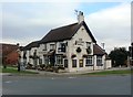

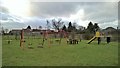
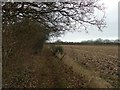

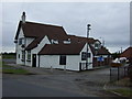
21 photos from this area
Area Information
Key information about the DN9 3AN including its size, population, and administrative classification.
- Area Type
- Postcode
- Area Size
- 6.3 hectares
- Population
- 1770
- Population Density
- 113 people/km²
House Prices in DN9 3AN
21
Properties
£243,909
Average Sold Price
£38,000
Lowest Price
£440,000
Highest Price
Showing 21 properties
| Address | Type | Beds | Baths | Last Sale Price | Last Sale Date | |
|---|---|---|---|---|---|---|
| 11 Bank End Road, Blaxton, Doncaster, DN9 3AN | house | - | - | £180,000 | Aug 2024 | |
| Bank End House, Bank End Road, Blaxton, Doncaster, DN9 3AN | Detached | 4 | 2 | £365,000 | Jun 2024 | |
| Marstan House, Bank End Road, Blaxton, Doncaster, DN9 3AN | Retail | 4 | 2 | £390,000 | Sep 2022 | |
| 15 Bank End Road, Blaxton, Doncaster, DN9 3AN | Bungalow | 4 | 1 | £155,000 | Dec 2021 | |
| The Pines, Bank End Road, Blaxton, Doncaster, DN9 3AN | house | - | - | £440,000 | Jun 2021 | |
| Martindale, Bank End Road, Blaxton, Doncaster, DN9 3AN | Detached | 4 | 1 | £290,000 | Jan 2021 | |
| New Farm House, Bank End Road, Blaxton, Doncaster, DN9 3AN | Detached | 4 | - | £240,000 | Aug 2019 | |
| 3 Bank End Road, Blaxton, Doncaster, DN9 3AN | house | - | - | £130,000 | Jul 2017 | |
| Newholme, Bank End Road, Blaxton, Doncaster, DN9 3AN | Detached | 3 | 1 | £125,000 | Feb 2015 | |
| The Bungalow, Bank End Road, Blaxton, Doncaster, DN9 3AN | Detached | 4 | - | £330,000 | Jan 2015 |
Page 1 of 3
Energy Efficiency in DN9 3AN
Amenities
Schools
| Rank | School | Type | Entry gender | Ages |
|---|
Explore more schools in this area
Go to Schools tabDemographics
Household Size
Two person
most common
Accommodation Type
Houses
most common
Tenure
88
majority
Ethnic Group
White
most common
Religion
N/A
most common
Household Composition
N/A
most common
Age
47
median
Adults (30-64 years)
most common
Household Deprivation
N/A
with no deprivation
NS-SEC
38
in Lower managerial occupations
Explore more demographic insights in this area
Go to Demographics tabPlanning
Planning Constraints
- Flood RiskPremium
- Ramsar Wetland SitesPremium
- Area of Outstanding Natural BeautyPremium
- Protected Nature ReservePremium
- Protected WoodlandPremium