Area Overview for DN9 2LU
Photos of DN9 2LU
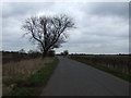
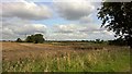
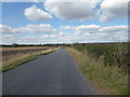
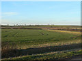
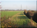
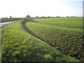
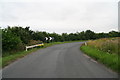
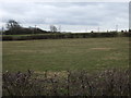
13 photos from this area
Area Information
Key information about the DN9 2LU including its size, population, and administrative classification.
- Area Type
- Postcode
- Area Size
- 83.5 hectares
- Population
- 1798
- Population Density
- 48 people/km²
House Prices in DN9 2LU
12
Properties
£183,917
Average Sold Price
£27,000
Lowest Price
£325,000
Highest Price
Showing 12 properties
| Address | Type | Beds | Baths | Last Sale Price | Last Sale Date | |
|---|---|---|---|---|---|---|
| Ashdene, Low Hall Road, East Lound, DN9 2LU | Detached | 4 | - | £325,000 | Aug 2018 | |
| The House At Pooh Corner, Low Hall Road, East Lound, DN9 2LU | house | - | - | £210,000 | Dec 2013 | |
| Wakefield Lodge, Low Hall Road, East Lound, DN9 2LU | Detached | - | - | £260,000 | Oct 2011 | |
| Mulberry House, Low Hall Road, East Lound, DN9 2LU | house | - | - | £195,000 | Apr 2000 | |
| Fieldside, Low Hall Road, East Lound, DN9 2LU | Detached | 3 | - | £86,500 | Nov 1999 | |
| Southwind Lodge, Low Hall Road, East Lound, DN9 2LU | Detached | - | - | £27,000 | Oct 1995 | |
| The Pig Barn, Low Hall Road, East Lound, DN9 2LU | Detached | - | - | - | - | |
| East View, Low Hall Road, East Lound, DN9 2LU | Detached | - | - | - | - | |
| Bracken View, Low Hall Road, East Lound, DN9 2LU | Detached | - | - | - | - | |
| South View, Low Hall Road, East Lound, DN9 2LU | Detached | - | - | - | - |
Page 1 of 2
Energy Efficiency in DN9 2LU
Amenities
Schools
| Rank | School | Type | Entry gender | Ages |
|---|
Explore more schools in this area
Go to Schools tabDemographics
Household Size
Two person
most common
Accommodation Type
Houses
most common
Tenure
90
majority
Ethnic Group
White
most common
Religion
N/A
most common
Household Composition
N/A
most common
Age
47
median
Adults (30-64 years)
most common
Household Deprivation
N/A
with no deprivation
NS-SEC
37
in Lower managerial occupations
Explore more demographic insights in this area
Go to Demographics tabPlanning
Planning Constraints
- Flood RiskPremium
- Ramsar Wetland SitesPremium
- Area of Outstanding Natural BeautyPremium
- Protected Nature ReservePremium
- Protected WoodlandPremium