Area Overview for DN9 2LT
Photos of DN9 2LT
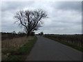
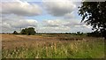
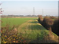
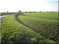
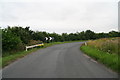
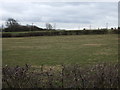
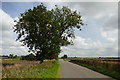
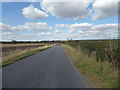
13 photos from this area
Area Information
Key information about the DN9 2LT including its size, population, and administrative classification.
- Area Type
- Postcode
- Area Size
- 63.8 hectares
- Population
- 1798
- Population Density
- 48 people/km²
House Prices in DN9 2LT
16
Properties
£235,150
Average Sold Price
£80,000
Lowest Price
£750,000
Highest Price
Showing 16 properties
| Address | Type | Beds | Baths | Last Sale Price | Last Sale Date | |
|---|---|---|---|---|---|---|
| 1, Dove Court, Carr Lane, East Lound, DN9 2LT | house | - | - | £120,000 | May 2022 | |
| The Brambles, Carr Lane, East Lound, DN9 2LT | house | - | - | £80,000 | Feb 2022 | |
| Karphi, Carr Lane, East Lound, DN9 2LT | Bungalow | - | - | £295,000 | Dec 2021 | |
| Carr House, Carr Lane, East Lound, DN9 2LT | Detached | 5 | 3 | £348,500 | Oct 2020 | |
| The Holt, Carr Lane, East Lound, DN9 2LT | Bungalow | 4 | - | £305,000 | Apr 2020 | |
| The Paddock, Carr Lane, East Lound, DN9 2LT | Detached | 8 | 5 | £750,000 | Mar 2020 | |
| The Meadows, Carr Lane, East Lound, DN9 2LT | house | - | - | £145,000 | Sep 2018 | |
| 4, Dove Court, Carr Lane, East Lound, DN9 2LT | Cottage | 2 | 1 | £112,000 | Jul 2017 | |
| 2, Dove Court, Carr Lane, East Lound, DN9 2LT | Farm | 2 | 1 | £84,000 | Jun 2015 | |
| 3, Dove Court, Carr Lane, East Lound, DN9 2LT | Terraced | 2 | - | £112,000 | Sep 2005 |
Page 1 of 2
Energy Efficiency in DN9 2LT
Amenities
Schools
| Rank | School | Type | Entry gender | Ages |
|---|
Explore more schools in this area
Go to Schools tabDemographics
Household Size
Two person
most common
Accommodation Type
Houses
most common
Tenure
90
majority
Ethnic Group
White
most common
Religion
N/A
most common
Household Composition
N/A
most common
Age
47
median
Adults (30-64 years)
most common
Household Deprivation
N/A
with no deprivation
NS-SEC
37
in Lower managerial occupations
Explore more demographic insights in this area
Go to Demographics tabPlanning
Planning Constraints
- Flood RiskPremium
- Ramsar Wetland SitesPremium
- Area of Outstanding Natural BeautyPremium
- Protected Nature ReservePremium
- Protected WoodlandPremium