Area Overview for DN8 4PE
Photos of DN8 4PE
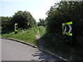
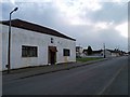
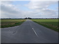
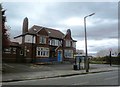
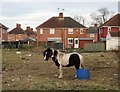
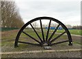
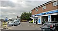
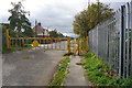
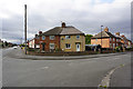
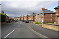
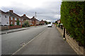
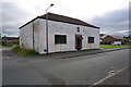
42 photos from this area
Area Information
Key information about the DN8 4PE including its size, population, and administrative classification.
- Area Type
- Postcode
- Area Size
- 1.1 hectares
- Population
- 1764
- Population Density
- 2200 people/km²
House Prices in DN8 4PE
26
Properties
£82,349
Average Sold Price
£33,000
Lowest Price
£131,500
Highest Price
Showing 26 properties
| Address | Type | Beds | Baths | Last Sale Price | Last Sale Date | |
|---|---|---|---|---|---|---|
| 4 The Hermitage, Moorends, Doncaster, DN8 4PE | Detached | 3 | 1 | £120,000 | Oct 2025 | |
| 24 The Hermitage, Moorends, Doncaster, DN8 4PE | Terraced | 3 | 1 | £131,500 | Nov 2023 | |
| 14 The Hermitage, Moorends, Doncaster, DN8 4PE | house | - | - | £115,000 | Jan 2022 | |
| 6 The Hermitage, Moorends, Doncaster, DN8 4PE | house | 3 | - | £85,000 | Jan 2018 | |
| 16 The Hermitage, Moorends, Doncaster, DN8 4PE | Semi-detached | - | - | £56,995 | Jun 2003 | |
| 22 The Hermitage, Moorends, Doncaster, DN8 4PE | Terraced | - | - | £33,000 | Sep 2002 | |
| 10 The Hermitage, Moorends, Doncaster, DN8 4PE | Semi-detached | - | - | £34,950 | Feb 1997 | |
| 8 The Hermitage, Moorends, Doncaster, DN8 4PE | Semi-detached | 3 | 1 | - | - | |
| 5 The Hermitage, Moorends, Doncaster, DN8 4PE | Bungalow | - | - | - | - | |
| 2 The Hermitage, Moorends, Doncaster, DN8 4PE | Semi-detached | - | - | - | - |
Page 1 of 3
Energy Efficiency in DN8 4PE
Amenities
Schools
| Rank | School | Type | Entry gender | Ages |
|---|
Explore more schools in this area
Go to Schools tabDemographics
Household Size
Family (3-5 people)
most common
Accommodation Type
Houses
most common
Tenure
44
majority
Ethnic Group
White
most common
Religion
N/A
most common
Household Composition
N/A
most common
Age
47
median
Adults (30-64 years)
most common
Household Deprivation
N/A
with no deprivation
NS-SEC
12
in Lower managerial occupations
Explore more demographic insights in this area
Go to Demographics tabPlanning
Planning Constraints
- Flood RiskPremium
- Ramsar Wetland SitesPremium
- Area of Outstanding Natural BeautyPremium
- Protected Nature ReservePremium
- Protected WoodlandPremium