Area Overview for DN38 6DW
Photos of DN38 6DW


Area Information
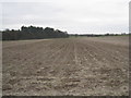
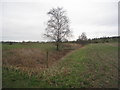
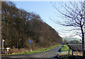
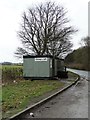
DN38 6DW is a small, tightly knit residential area in England, covering 23.5 hectares and home to 2036 people. Its compact size means it’s a quiet, low-density neighbourhood, with a population density of just 115 people per square kilometre. The area is characterised by a mature demographic, with a median age of 47 and a majority of residents aged between 30 and 64. This suggests a community of established families and professionals, many of whom own their homes—71% of properties are owner-occupied. Daily life here is likely to be steady and predictable, with access to nearby amenities such as retail stores, rail stations, and a primary school. The presence of three rail stations, including Barnetby and Brigg, ensures reasonable connectivity to nearby towns. For those seeking a peaceful, stable environment with practical infrastructure, DN38 6DW offers a balance of seclusion and accessibility. Its proximity to Humberside Airport and a range of local shops makes it appealing to those who value convenience without the bustle of larger urban centres.
- Area Type
- Postcode
- Area Size
- 23.5 hectares
- Population
- 2036
- Population Density
- 115 people/km²
DN38 6DW is predominantly an owner-occupied area, with 71% of homes owned by residents rather than rented. The accommodation type is primarily houses, which is typical for a low-density, suburban postcode. This suggests a market skewed towards family homes and long-term residency rather than short-term rental properties. The small size of the area—23.5 hectares—means the housing stock is limited, which could make it a competitive market for buyers. The presence of nearby rail stations and retail amenities adds to the area’s appeal, particularly for those seeking a balance between rural tranquillity and practical connectivity. For buyers, this means a focus on existing properties rather than new developments, with potential for stable value retention. However, the limited size of the area may also mean fewer options for those seeking specific property features or larger homes.
House Prices in DN38 6DW
Showing 1 properties
| Address | Type | Beds | Baths | Last Sale Price | Last Sale Date | |
|---|---|---|---|---|---|---|
| Rear Of Gallows Wood Service Station, A 18 Between Wrawby And Barnetby Top, Melton Ross, DN38 6DW | Detached | - | - | - | - |
Energy Efficiency in DN38 6DW
Daily life in DN38 6DW is supported by a range of nearby amenities. The area has five retail outlets, including Lincolnshire Co-operative Co, Morrisons Daily, and Tesco Brigg, providing access to groceries, household essentials, and convenience shopping. For travel, three rail stations—Barnetby, Brigg, and Ulceby—offer connections to broader regional networks, while Humberside Airport is within reach for those needing air travel. Though the data does not list parks or leisure facilities explicitly, the low population density and absence of planning constraints suggest open spaces may be available nearby. The combination of local shops, rail access, and proximity to an airport means residents can enjoy a mix of convenience and practicality, with minimal need to travel far for essentials.
Amenities
Schools
The nearest school to DN38 6DW is St Barnabas CofE Primary School in Barnetby, which is a primary school with an Ofsted rating of satisfactory. This provides a local option for families with young children, though the data does not indicate the presence of secondary schools or other educational institutions in the immediate vicinity. The single primary school suggests that parents may need to consider commuting to nearby towns for secondary education. For families prioritising proximity to schools, the availability of a primary school is a key factor, though the lack of additional educational facilities may influence decisions about long-term residency. The satisfactory Ofsted rating indicates that the school meets basic standards but may not be among the top-performing institutions in the region.
| Rank | School | Type | Entry gender | Ages |
|---|
Explore more schools in this area
Go to Schools tabDemographics
The population of DN38 6DW is predominantly composed of adults aged 30 to 64, reflecting a mature, established community. With a median age of 47, the area is less likely to have a high proportion of young families or retirees compared to other regions. Home ownership is strong, with 71% of residents owning their homes, indicating a stable housing market and long-term residency. The accommodation type is primarily houses, which aligns with the area’s low density and suburban feel. The predominant ethnic group is White, which is common in smaller, rural postcode areas. While specific data on deprivation is not provided, the high home ownership rate and low population density suggest a relatively affluent or stable community. This demographic profile means the area is likely to have a slower pace of change, with a focus on maintaining local character and services.
Household Size
Accommodation Type
Tenure
Ethnic Group
Religion
Household Composition
Age
Household Deprivation
NS-SEC
Explore more demographic insights in this area
Go to Demographics tabPlanning
Planning Constraints
- Flood RiskPremium
- Ramsar Wetland SitesPremium
- Area of Outstanding Natural BeautyPremium
- Protected Nature ReservePremium
- Protected WoodlandPremium