Area Overview for DN38 6DL
Photos of DN38 6DL
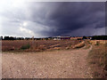
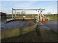
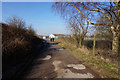
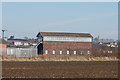
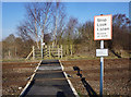

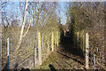

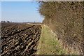
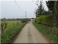
35 photos from this area
Area Information
Key information about the DN38 6DL including its size, population, and administrative classification.
- Area Type
- Postcode
- Area Size
- 69.1 hectares
- Population
- 2036
- Population Density
- 115 people/km²
House Prices in DN38 6DL
11
Properties
£316,667
Average Sold Price
£290,000
Lowest Price
£360,000
Highest Price
Showing 11 properties
| Address | Type | Beds | Baths | Last Sale Price | Last Sale Date | |
|---|---|---|---|---|---|---|
| Catkins Cottage, Coskills, Barnetby Le Wold, DN38 6DL | Detached | 3 | 2 | £300,000 | Sep 2016 | |
| Cawood Cottage, Coskills, Barnetby Le Wold, DN38 6DL | house | - | - | £290,000 | Aug 2014 | |
| Rowan Lodge, Coskills, Barnetby Le Wold, DN38 6DL | Detached | - | - | £360,000 | Jun 2003 | |
| Catkins Cottage, Coskills, Barnetby Le Wold, DN38 6DL | Semi-detached | - | - | - | - | |
| Rookery Farm, Railway Street, Barnetby Le Wold, DN38 6DL | Detached | - | - | - | - | |
| Kennels, Rookery Farm, Railway Street, Barnetby Le Wold, DN38 6DL | commercial | - | - | - | - | |
| Caravan, Coskills, Barnetby Le Wold, DN38 6DL | Semi-detached | - | - | - | - | |
| Annexe, Rookery Farm, Railway Street, Barnetby Le Wold, DN38 6DL | Flat | - | - | - | - | |
| Coskills Farm, Coskills, Barnetby Le Wold, DN38 6DL | house | - | - | - | - | |
| Hare Hills Cottage, Coskills, Barnetby Le Wold, DN38 6DL | house | - | - | - | - |
Page 1 of 2
Energy Efficiency in DN38 6DL
Amenities
Schools
| Rank | School | Type | Entry gender | Ages |
|---|
Explore more schools in this area
Go to Schools tabDemographics
Household Size
Two person
most common
Accommodation Type
Houses
most common
Tenure
71
majority
Ethnic Group
White
most common
Religion
N/A
most common
Household Composition
N/A
most common
Age
47
median
Adults (30-64 years)
most common
Household Deprivation
N/A
with no deprivation
NS-SEC
27
in Lower managerial occupations
Explore more demographic insights in this area
Go to Demographics tabPlanning
Planning Constraints
- Flood RiskPremium
- Ramsar Wetland SitesPremium
- Area of Outstanding Natural BeautyPremium
- Protected Nature ReservePremium
- Protected WoodlandPremium