Area Overview for DN36 4SX
Photos of DN36 4SX
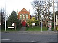
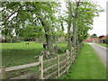
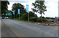
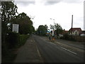
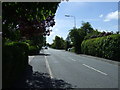
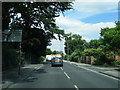
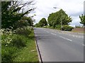
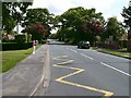
14 photos from this area
Area Information
Key information about the DN36 4SX including its size, population, and administrative classification.
- Area Type
- Postcode
- Area Size
- 16.8 hectares
- Population
- 1313
- Population Density
- 650 people/km²
House Prices in DN36 4SX
13
Properties
£296,167
Average Sold Price
£163,000
Lowest Price
£405,000
Highest Price
Showing 13 properties
| Address | Type | Beds | Baths | Last Sale Price | Last Sale Date | |
|---|---|---|---|---|---|---|
| 149 Humberston Avenue, Humberston, DN36 4SX | Detached | 3 | 3 | £405,000 | Nov 2019 | |
| 159 Humberston Avenue, Humberston, DN36 4SX | Bungalow | 3 | - | £275,000 | Oct 2012 | |
| 143 Humberston Avenue, Humberston, DN36 4SX | Detached | - | - | £354,000 | May 2004 | |
| 147 Humberston Avenue, Humberston, DN36 4SX | Land | - | - | £375,000 | Jun 2003 | |
| 157 Humberston Avenue, Humberston, DN36 4SX | Land | - | - | £163,000 | Jun 2001 | |
| 155 Humberston Avenue, Humberston, DN36 4SX | Detached | - | - | £205,000 | Oct 1997 | |
| 145A Humberston Avenue, Humberston, DN36 4SX | Land | 4 | - | - | - | |
| 145 Humberston Avenue, Humberston, DN36 4SX | Detached | 4 | 1 | - | - | |
| 153 Humberston Avenue, Humberston, DN36 4SX | Land | 6 | 4 | - | - | |
| 151 Humberston Avenue, Humberston, DN36 4SX | Detached | 5 | 2 | - | - |
Page 1 of 2
Energy Efficiency in DN36 4SX
Amenities
Schools
| Rank | School | Type | Entry gender | Ages |
|---|
Explore more schools in this area
Go to Schools tabDemographics
Household Size
Two person
most common
Accommodation Type
Houses
most common
Tenure
92
majority
Ethnic Group
White
most common
Religion
N/A
most common
Household Composition
N/A
most common
Age
47
median
Adults (30-64 years)
most common
Household Deprivation
N/A
with no deprivation
NS-SEC
32
in Lower managerial occupations
Explore more demographic insights in this area
Go to Demographics tabPlanning
Planning Constraints
- Flood RiskPremium
- Ramsar Wetland SitesPremium
- Area of Outstanding Natural BeautyPremium
- Protected Nature ReservePremium
- Protected WoodlandPremium