Area Overview for DN36 4ST
Photos of DN36 4ST
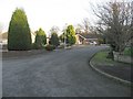
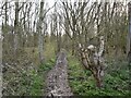
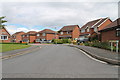
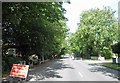
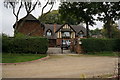
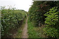
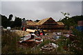
11 photos from this area
Area Information
Key information about the DN36 4ST including its size, population, and administrative classification.
- Area Type
- Postcode
- Area Size
- 17.3 hectares
- Population
- 1313
- Population Density
- 650 people/km²
House Prices in DN36 4ST
27
Properties
£421,358
Average Sold Price
£160,000
Lowest Price
£1,109,727
Highest Price
Showing 27 properties
| Address | Type | Beds | Baths | Last Sale Price | Last Sale Date | |
|---|---|---|---|---|---|---|
| 97 Humberston Avenue, Humberston, DN36 4ST | Bungalow | 3 | 5 | £1,109,727 | Mar 2025 | |
| 119 Humberston Avenue, Humberston, DN36 4ST | house | - | - | £622,000 | Apr 2024 | |
| 99 Humberston Avenue, Humberston, DN36 4ST | house | 4 | 2 | £465,000 | Jan 2024 | |
| 137 Humberston Avenue, Humberston, DN36 4ST | Detached | 4 | - | £380,000 | Aug 2023 | |
| 117 Humberston Avenue, Humberston, DN36 4ST | Detached | 6 | 3 | £705,000 | Jun 2022 | |
| 131 Humberston Avenue, Humberston, DN36 4ST | Detached | 5 | 1 | £565,000 | Dec 2020 | |
| 125 Humberston Avenue, Humberston, DN36 4ST | Bungalow | 4 | 2 | £380,000 | Aug 2019 | |
| 133 Humberston Avenue, Humberston, DN36 4ST | house | 3 | - | £312,500 | Jul 2018 | |
| 123 Humberston Avenue, Humberston, DN36 4ST | Detached | - | - | £160,000 | Oct 2017 | |
| 103 Humberston Avenue, Humberston, DN36 4ST | Detached | 4 | 2 | £340,000 | Apr 2017 |
Page 1 of 3
Energy Efficiency in DN36 4ST
Amenities
Schools
| Rank | School | Type | Entry gender | Ages |
|---|
Explore more schools in this area
Go to Schools tabDemographics
Household Size
Two person
most common
Accommodation Type
Houses
most common
Tenure
92
majority
Ethnic Group
White
most common
Religion
N/A
most common
Household Composition
N/A
most common
Age
47
median
Adults (30-64 years)
most common
Household Deprivation
N/A
with no deprivation
NS-SEC
32
in Lower managerial occupations
Explore more demographic insights in this area
Go to Demographics tabPlanning
Planning Constraints
- Flood RiskPremium
- Ramsar Wetland SitesPremium
- Area of Outstanding Natural BeautyPremium
- Protected Nature ReservePremium
- Protected WoodlandPremium