Area Overview for DN34 5HY
Photos of DN34 5HY
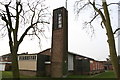
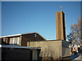
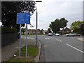

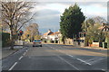
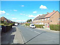
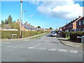
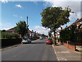
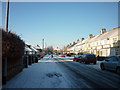
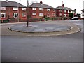
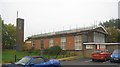
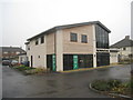
21 photos from this area
Area Information
Key information about the DN34 5HY including its size, population, and administrative classification.
- Area Type
- Postcode
- Area Size
- 9076 m²
- Population
- 1369
- Population Density
- 4799 people/km²
House Prices in DN34 5HY
22
Properties
£64,300
Average Sold Price
£17,500
Lowest Price
£92,000
Highest Price
Showing 22 properties
| Address | Type | Beds | Baths | Last Sale Price | Last Sale Date | |
|---|---|---|---|---|---|---|
| 29 Carnforth Crescent, Grimsby, DN34 5HY | house | - | - | £60,000 | Feb 2021 | |
| 9 Carnforth Crescent, Grimsby, DN34 5HY | Terraced | 3 | 1 | £92,000 | Aug 2020 | |
| 19 Carnforth Crescent, Grimsby, DN34 5HY | house | 3 | - | £78,000 | Apr 2019 | |
| 31 Carnforth Crescent, Grimsby, DN34 5HY | Terraced | 3 | 1 | £67,000 | Nov 2014 | |
| 13 Carnforth Crescent, Grimsby, DN34 5HY | Terraced | 3 | - | £63,000 | Oct 2013 | |
| 17 Carnforth Crescent, Grimsby, DN34 5HY | Terraced | - | - | £72,000 | Nov 2007 | |
| 7 Carnforth Crescent, Grimsby, DN34 5HY | Terraced | 3 | 2 | £75,000 | Jan 2007 | |
| 5 Carnforth Crescent, Grimsby, DN34 5HY | Terraced | - | - | £63,000 | Aug 2006 | |
| 41 Carnforth Crescent, Grimsby, DN34 5HY | Terraced | - | - | £55,500 | Jul 2005 | |
| 15 Carnforth Crescent, Grimsby, DN34 5HY | Terraced | 3 | 1 | £17,500 | Mar 2001 |
Page 1 of 3
Energy Efficiency in DN34 5HY
Amenities
Schools
| Rank | School | Type | Entry gender | Ages |
|---|
Explore more schools in this area
Go to Schools tabDemographics
Household Size
Family (3-5 people)
most common
Accommodation Type
Houses
most common
Tenure
57
majority
Ethnic Group
White
most common
Religion
N/A
most common
Household Composition
N/A
most common
Age
47
median
Adults (30-64 years)
most common
Household Deprivation
N/A
with no deprivation
NS-SEC
13
in Lower managerial occupations
Explore more demographic insights in this area
Go to Demographics tabPlanning
Planning Constraints
- Flood RiskPremium
- Ramsar Wetland SitesPremium
- Area of Outstanding Natural BeautyPremium
- Protected Nature ReservePremium
- Protected WoodlandPremium