Area Overview for DN34 5HA
Photos of DN34 5HA

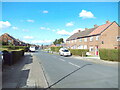
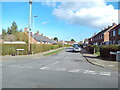
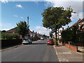
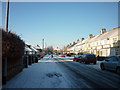
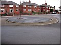

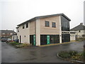
21 photos from this area
Area Information
Key information about the DN34 5HA including its size, population, and administrative classification.
- Area Type
- Postcode
- Area Size
- 7204 m²
- Population
- 1369
- Population Density
- 4799 people/km²
House Prices in DN34 5HA
22
Properties
£69,897
Average Sold Price
£15,000
Lowest Price
£110,000
Highest Price
Showing 22 properties
| Address | Type | Beds | Baths | Last Sale Price | Last Sale Date | |
|---|---|---|---|---|---|---|
| 29 Worcester Avenue, Grimsby, DN34 5HA | house | 2 | 2 | £93,000 | Feb 2025 | |
| 39 Worcester Avenue, Grimsby, DN34 5HA | Terraced | 4 | 1 | £95,000 | Aug 2023 | |
| 19 Worcester Avenue, Grimsby, DN34 5HA | house | - | - | £107,500 | Jul 2022 | |
| 33 Worcester Avenue, Grimsby, DN34 5HA | house | 3 | 1 | £110,000 | Nov 2021 | |
| 7 Worcester Avenue, Grimsby, DN34 5HA | house | - | - | £109,950 | Jul 2021 | |
| 47 Worcester Avenue, Grimsby, DN34 5HA | house | 4 | - | £100,000 | Nov 2020 | |
| 15 Worcester Avenue, Grimsby, DN34 5HA | Terraced | 3 | 1 | £72,500 | Feb 2020 | |
| 45 Worcester Avenue, Grimsby, DN34 5HA | Semi-detached | 3 | 1 | £57,500 | Jan 2017 | |
| 17 Worcester Avenue, Grimsby, DN34 5HA | Terraced | 3 | 1 | £42,500 | Nov 2011 | |
| 11 Worcester Avenue, Grimsby, DN34 5HA | house | - | - | £37,210 | May 2005 |
Page 1 of 3
Energy Efficiency in DN34 5HA
Amenities
Schools
| Rank | School | Type | Entry gender | Ages |
|---|
Explore more schools in this area
Go to Schools tabDemographics
Household Size
Family (3-5 people)
most common
Accommodation Type
Houses
most common
Tenure
57
majority
Ethnic Group
White
most common
Religion
N/A
most common
Household Composition
N/A
most common
Age
47
median
Adults (30-64 years)
most common
Household Deprivation
N/A
with no deprivation
NS-SEC
13
in Lower managerial occupations
Explore more demographic insights in this area
Go to Demographics tabPlanning
Planning Constraints
- Flood RiskPremium
- Ramsar Wetland SitesPremium
- Area of Outstanding Natural BeautyPremium
- Protected Nature ReservePremium
- Protected WoodlandPremium