Area Overview for DN32 0PD
Photos of DN32 0PD
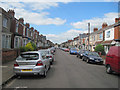

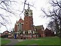
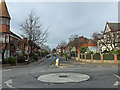
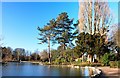
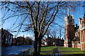
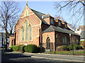
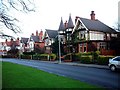
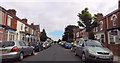
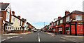
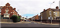
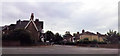
72 photos from this area
Area Information
Key information about the DN32 0PD including its size, population, and administrative classification.
- Area Type
- Postcode
- Area Size
- 2.4 hectares
- Population
- 1317
- Population Density
- 3596 people/km²
House Prices in DN32 0PD
65
Properties
£48,994
Average Sold Price
£15,000
Lowest Price
£87,000
Highest Price
Showing 65 properties
| Address | Type | Beds | Baths | Last Sale Price | Last Sale Date | |
|---|---|---|---|---|---|---|
| 57 Wintringham Road, Grimsby, DN32 0PD | Terraced | 3 | 2 | £75,000 | Jul 2025 | |
| 11 Wintringham Road, Grimsby, DN32 0PD | Terraced | 2 | - | £60,000 | Jun 2025 | |
| 21 Wintringham Road, Grimsby, DN32 0PD | house | - | - | £47,000 | Feb 2025 | |
| 75 Wintringham Road, Grimsby, DN32 0PD | Terraced | 2 | 1 | £39,999 | Dec 2024 | |
| 49 Wintringham Road, Grimsby, DN32 0PD | Terraced | 3 | 1 | £59,000 | Oct 2024 | |
| 91 Wintringham Road, Grimsby, DN32 0PD | Terraced | 3 | 1 | £52,950 | Apr 2024 | |
| 43 Wintringham Road, Grimsby, DN32 0PD | Terraced | 3 | - | £45,000 | Dec 2023 | |
| 23 Wintringham Road, Grimsby, DN32 0PD | Terraced | 2 | 1 | £45,000 | Jul 2023 | |
| 103 Wintringham Road, Grimsby, DN32 0PD | Terraced | 2 | 1 | £60,000 | Apr 2023 | |
| 33 Wintringham Road, Grimsby, DN32 0PD | Terraced | 3 | 1 | £59,950 | Oct 2022 |
Page 1 of 7
Energy Efficiency in DN32 0PD
Amenities
Schools
| Rank | School | Type | Entry gender | Ages |
|---|
Explore more schools in this area
Go to Schools tabDemographics
Household Size
One person
most common
Accommodation Type
Flats
most common
Tenure
34
majority
Ethnic Group
White
most common
Religion
N/A
most common
Household Composition
N/A
most common
Age
47
median
Adults (30-64 years)
most common
Household Deprivation
N/A
with no deprivation
NS-SEC
18
in Lower managerial occupations
Explore more demographic insights in this area
Go to Demographics tabPlanning
Planning Constraints
- Flood RiskPremium
- Ramsar Wetland SitesPremium
- Area of Outstanding Natural BeautyPremium
- Protected Nature ReservePremium
- Protected WoodlandPremium