Area Overview for DN32 0NX
Photos of DN32 0NX
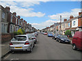

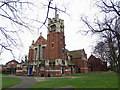
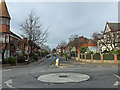
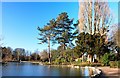
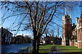
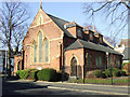
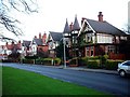
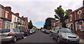
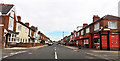
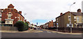
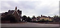
72 photos from this area
Area Information
Key information about the DN32 0NX including its size, population, and administrative classification.
- Area Type
- Postcode
- Area Size
- 3973 m²
- Population
- 1483
- Population Density
- 10646 people/km²
House Prices in DN32 0NX
25
Properties
£50,571
Average Sold Price
£25,000
Lowest Price
£85,000
Highest Price
Showing 25 properties
| Address | Type | Beds | Baths | Last Sale Price | Last Sale Date | |
|---|---|---|---|---|---|---|
| 78 Wintringham Road, Grimsby, DN32 0NX | Terraced | 3 | 2 | £75,000 | Jun 2024 | |
| 102 Wintringham Road, Grimsby, DN32 0NX | Terraced | 2 | - | £85,000 | Feb 2022 | |
| 74 Wintringham Road, Grimsby, DN32 0NX | house | - | - | £72,000 | Oct 2021 | |
| 84 Wintringham Road, Grimsby, DN32 0NX | Terraced | 3 | 1 | £55,000 | Mar 2021 | |
| 94 Wintringham Road, Grimsby, DN32 0NX | Terraced | 3 | 1 | £51,000 | Jul 2019 | |
| 92 Wintringham Road, Grimsby, DN32 0NX | Terraced | 3 | - | £47,200 | May 2019 | |
| 98 Wintringham Road, Grimsby, DN32 0NX | Terraced | 2 | 1 | £58,000 | Mar 2018 | |
| 86 Wintringham Road, Grimsby, DN32 0NX | Terraced | 3 | 1 | £29,000 | Jan 2017 | |
| 62 Wintringham Road, Grimsby, DN32 0NX | Terraced | 3 | 1 | £25,000 | May 2013 | |
| 82 Wintringham Road, Grimsby, DN32 0NX | house | 3 | - | £65,000 | Jan 2012 |
Page 1 of 3
Energy Efficiency in DN32 0NX
Amenities
Schools
| Rank | School | Type | Entry gender | Ages |
|---|
Explore more schools in this area
Go to Schools tabDemographics
Household Size
Family (3-5 people)
most common
Accommodation Type
Houses
most common
Tenure
41
majority
Ethnic Group
White
most common
Religion
N/A
most common
Household Composition
N/A
most common
Age
47
median
Adults (30-64 years)
most common
Household Deprivation
N/A
with no deprivation
NS-SEC
16
in Lower managerial occupations
Explore more demographic insights in this area
Go to Demographics tabPlanning
Planning Constraints
- Flood RiskPremium
- Ramsar Wetland SitesPremium
- Area of Outstanding Natural BeautyPremium
- Protected Nature ReservePremium
- Protected WoodlandPremium