Area Overview for DN20 9NE
Photos of DN20 9NE

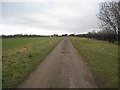

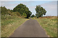
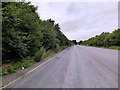

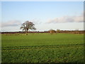
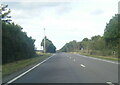

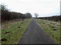
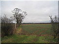
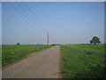
18 photos from this area
Area Information
Key information about the DN20 9NE including its size, population, and administrative classification.
- Area Type
- Postcode
- Area Size
- 1.5 km²
- Population
- 1442
- Population Density
- 26 people/km²
House Prices in DN20 9NE
31
Properties
£241,206
Average Sold Price
£81,000
Lowest Price
£575,000
Highest Price
Showing 31 properties
| Address | Type | Beds | Baths | Last Sale Price | Last Sale Date | |
|---|---|---|---|---|---|---|
| 88 Messingham Lane, Greetwell, DN20 9NE | Bungalow | - | - | £335,000 | Aug 2023 | |
| 99 Messingham Lane, Greetwell, DN20 9NE | Bungalow | 2 | 1 | £305,000 | Jan 2023 | |
| 85 Messingham Lane, Greetwell, DN20 9NE | Bungalow | - | - | £291,000 | Sep 2022 | |
| 82 Messingham Lane, Greetwell, DN20 9NE | house | - | - | £215,000 | Feb 2022 | |
| 90 Messingham Lane, Greetwell, DN20 9NE | Bungalow | - | - | £250,000 | Jan 2021 | |
| The Heathers, Messingham Lane, Scawby, DN20 9NE | Bungalow | - | - | £460,000 | Nov 2020 | |
| Merry Lodge, 89 Messingham Lane, Greetwell, DN20 9NE | house | - | - | £575,000 | Jul 2020 | |
| 76 Messingham Lane, Greetwell, DN20 9NE | house | - | - | £200,000 | Jan 2020 | |
| 96 Messingham Lane, Greetwell, DN20 9NE | house | - | - | £280,500 | Oct 2007 | |
| 86 Messingham Lane, Greetwell, DN20 9NE | Detached | - | - | £210,000 | Jun 2006 |
Page 1 of 4
Energy Efficiency in DN20 9NE
Amenities
Schools
| Rank | School | Type | Entry gender | Ages |
|---|
Explore more schools in this area
Go to Schools tabDemographics
Household Size
Two person
most common
Accommodation Type
Houses
most common
Tenure
83
majority
Ethnic Group
White
most common
Religion
N/A
most common
Household Composition
N/A
most common
Age
47
median
Adults (30-64 years)
most common
Household Deprivation
N/A
with no deprivation
NS-SEC
35
in Lower managerial occupations
Explore more demographic insights in this area
Go to Demographics tabPlanning
Planning Constraints
- Flood RiskPremium
- Ramsar Wetland SitesPremium
- Area of Outstanding Natural BeautyPremium
- Protected Nature ReservePremium
- Protected WoodlandPremium