Area Overview for DN20 8SH
Photos of DN20 8SH
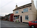
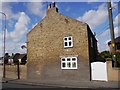
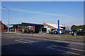
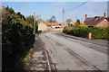
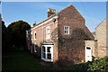
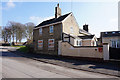
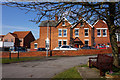
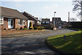
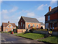
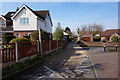
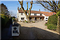
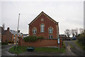
36 photos from this area
Area Information
Key information about the DN20 8SH including its size, population, and administrative classification.
- Area Type
- Postcode
- Area Size
- 41.1 hectares
- Population
- 1773
- Population Density
- 158 people/km²
House Prices in DN20 8SH
36
Properties
£191,319
Average Sold Price
£79,000
Lowest Price
£380,000
Highest Price
Showing 36 properties
| Address | Type | Beds | Baths | Last Sale Price | Last Sale Date | |
|---|---|---|---|---|---|---|
| Vale View, Barton Road, Wrawby, DN20 8SH | Bungalow | - | - | £249,000 | Feb 2025 | |
| The Chimneys, Barton Road, Wrawby, DN20 8SH | Semi-detached | 3 | 1 | £187,500 | Jun 2022 | |
| Villette, Barton Road, Wrawby, DN20 8SH | Detached | 4 | 2 | £262,500 | Jul 2019 | |
| Park Lea, Barton Road, Wrawby, DN20 8SH | Detached | 4 | 2 | £380,000 | Oct 2017 | |
| Rowan Lodge, Barton Road, Wrawby, DN20 8SH | Detached | 2 | - | £170,000 | Aug 2017 | |
| Springwell, Barton Road, Wrawby, DN20 8SH | house | - | - | £207,500 | Jul 2017 | |
| Montana, Barton Road, Wrawby, DN20 8SH | Bungalow | - | - | £220,000 | Dec 2016 | |
| The Coach House, Barton Road, Wrawby, DN20 8SH | house | - | - | £133,000 | Jun 2016 | |
| The Squirrels, Barton Road, Wrawby, DN20 8SH | Detached | 4 | - | £178,000 | Jul 2014 | |
| Top Cottage, Barton Road, Wrawby, DN20 8SH | house | - | - | £285,000 | Sep 2010 |
Page 1 of 4
Energy Efficiency in DN20 8SH
Amenities
Schools
| Rank | School | Type | Entry gender | Ages |
|---|
Explore more schools in this area
Go to Schools tabDemographics
Household Size
Two person
most common
Accommodation Type
Houses
most common
Tenure
83
majority
Ethnic Group
White
most common
Religion
N/A
most common
Household Composition
N/A
most common
Age
47
median
Adults (30-64 years)
most common
Household Deprivation
N/A
with no deprivation
NS-SEC
37
in Lower managerial occupations
Explore more demographic insights in this area
Go to Demographics tabPlanning
Planning Constraints
- Flood RiskPremium
- Ramsar Wetland SitesPremium
- Area of Outstanding Natural BeautyPremium
- Protected Nature ReservePremium
- Protected WoodlandPremium