Area Overview for DN20 8RR
Photos of DN20 8RR
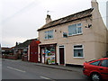
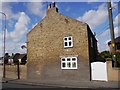
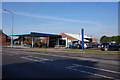
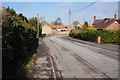
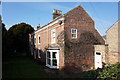
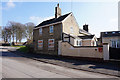
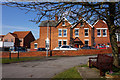
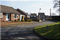
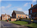
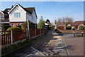
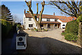

36 photos from this area
Area Information
Key information about the DN20 8RR including its size, population, and administrative classification.
- Area Type
- Postcode
- Area Size
- 1.9 hectares
- Population
- 1773
- Population Density
- 158 people/km²
House Prices in DN20 8RR
22
Properties
£191,962
Average Sold Price
£65,000
Lowest Price
£480,000
Highest Price
Showing 22 properties
| Address | Type | Beds | Baths | Last Sale Price | Last Sale Date | |
|---|---|---|---|---|---|---|
| Brooklands, Vicarage Road, Wrawby, DN20 8RR | Bungalow | 3 | 1 | £225,000 | Nov 2022 | |
| The Cottage, Vicarage Road, Wrawby, DN20 8RR | Semi-detached | 2 | 1 | £135,000 | Oct 2022 | |
| Central Stores, Vicarage Road, Wrawby, DN20 8RR | house | - | - | £365,000 | Jun 2022 | |
| Old Vicarage, Vicarage Road, Wrawby, DN20 8RR | house | - | - | £480,000 | Jun 2022 | |
| Finally, Vicarage Road, Wrawby, DN20 8RR | Bungalow | 2 | 1 | £200,000 | Jun 2021 | |
| Skylarks, Vicarage Road, Wrawby, DN20 8RR | Bungalow | - | - | £165,000 | Oct 2020 | |
| Old Post Office Row, Vicarage Road, Wrawby, DN20 8RR | house | 4 | 1 | £185,000 | Feb 2018 | |
| Beresford, Vicarage Road, Wrawby, DN20 8RR | Bungalow | 2 | 1 | £145,000 | Mar 2015 | |
| Porthceri, Vicarage Road, Wrawby, DN20 8RR | Bungalow | 2 | 1 | £85,000 | Jan 2015 | |
| Anfield Cottage, Vicarage Road, Wrawby, DN20 8RR | house | - | - | £100,500 | May 2010 |
Page 1 of 3
Energy Efficiency in DN20 8RR
Amenities
Schools
| Rank | School | Type | Entry gender | Ages |
|---|
Explore more schools in this area
Go to Schools tabDemographics
Household Size
Two person
most common
Accommodation Type
Houses
most common
Tenure
83
majority
Ethnic Group
White
most common
Religion
N/A
most common
Household Composition
N/A
most common
Age
47
median
Adults (30-64 years)
most common
Household Deprivation
N/A
with no deprivation
NS-SEC
37
in Lower managerial occupations
Explore more demographic insights in this area
Go to Demographics tabPlanning
Planning Constraints
- Flood RiskPremium
- Ramsar Wetland SitesPremium
- Area of Outstanding Natural BeautyPremium
- Protected Nature ReservePremium
- Protected WoodlandPremium