Area Overview for DN20 0RL
Photos of DN20 0RL
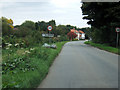
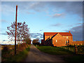
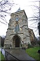
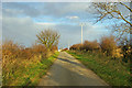
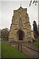
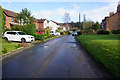
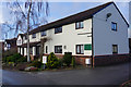
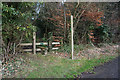
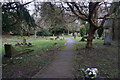
46 photos from this area
Area Information
Key information about the DN20 0RL including its size, population, and administrative classification.
- Area Type
- Postcode
- Area Size
- 1.3 hectares
- Population
- 1218
- Population Density
- 34 people/km²
House Prices in DN20 0RL
10
Properties
£222,280
Average Sold Price
£46,000
Lowest Price
£442,000
Highest Price
Showing 10 properties
| Address | Type | Beds | Baths | Last Sale Price | Last Sale Date | |
|---|---|---|---|---|---|---|
| 11 Maltkiln Lane, Elsham, DN20 0RL | Semi-detached | 3 | 1 | £225,000 | Apr 2023 | |
| Sycamore House, 4 Maltkiln Lane, Elsham, DN20 0RL | house | - | - | £442,000 | Sep 2021 | |
| 15 Maltkiln Lane, Elsham, DN20 0RL | Semi-detached | 3 | 1 | £183,400 | Feb 2021 | |
| 17 Maltkiln Lane, Elsham, DN20 0RL | house | - | - | £215,000 | Nov 2012 | |
| 9 Maltkiln Lane, Elsham, DN20 0RL | Semi-detached | 3 | 1 | £46,000 | Mar 2002 | |
| The Maltings, 3 Maltkiln Lane, Elsham, DN20 0RL | house | 4 | 2 | - | - | |
| The Bungalow, 1 Dunns Paddock, Elsham, DN20 0RL | Bungalow | 3 | 1 | - | - | |
| 2 Dunns Paddock, Elsham, DN20 0RL | Detached | 5 | 3 | - | - | |
| Blueberry House, 1 Maltkiln Lane, Elsham, DN20 0RL | Detached | 6 | 4 | - | - | |
| Darley, 5 Maltkiln Lane, Elsham, DN20 0RL | Detached | - | - | - | - |
Energy Efficiency in DN20 0RL
Amenities
Schools
| Rank | School | Type | Entry gender | Ages |
|---|
Explore more schools in this area
Go to Schools tabDemographics
Household Size
Two person
most common
Accommodation Type
Houses
most common
Tenure
76
majority
Ethnic Group
White
most common
Religion
N/A
most common
Household Composition
N/A
most common
Age
47
median
Adults (30-64 years)
most common
Household Deprivation
N/A
with no deprivation
NS-SEC
39
in Lower managerial occupations
Explore more demographic insights in this area
Go to Demographics tabPlanning
Planning Constraints
- Flood RiskPremium
- Ramsar Wetland SitesPremium
- Area of Outstanding Natural BeautyPremium
- Protected Nature ReservePremium
- Protected WoodlandPremium