Area Overview for DN20 0RG
Photos of DN20 0RG
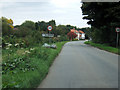
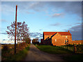
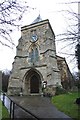
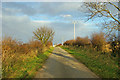
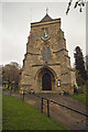
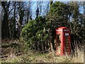
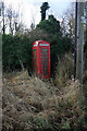
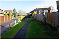
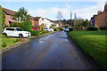
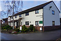
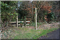
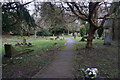
46 photos from this area
Area Information
Key information about the DN20 0RG including its size, population, and administrative classification.
- Area Type
- Postcode
- Area Size
- 52.6 hectares
- Population
- 1218
- Population Density
- 34 people/km²
House Prices in DN20 0RG
27
Properties
£332,094
Average Sold Price
£128,000
Lowest Price
£570,000
Highest Price
Showing 27 properties
| Address | Type | Beds | Baths | Last Sale Price | Last Sale Date | |
|---|---|---|---|---|---|---|
| Inglewood House, 17 Church Street, Elsham, DN20 0RG | house | 4 | 2 | £515,000 | Jun 2024 | |
| 2 Church Street, Elsham, DN20 0RG | house | - | - | £165,000 | May 2021 | |
| 4 Church Street, Elsham, DN20 0RG | Semi-detached | 2 | 1 | £250,000 | Apr 2021 | |
| Rosedale House, 21 Church Street, Elsham, DN20 0RG | Detached | 4 | 2 | £280,000 | Jan 2020 | |
| Meadoway, 14 Church Street, Elsham, DN20 0RG | Land | 1 | 1 | £570,000 | Aug 2018 | |
| Windsor, 26 Church Street, Elsham, DN20 0RG | Detached | 5 | 3 | £520,000 | Oct 2017 | |
| Spring House, 29 Church Street, Elsham, DN20 0RG | house | - | - | £525,000 | Aug 2016 | |
| 23 Church Street, Elsham, DN20 0RG | house | - | - | £400,000 | Jul 2016 | |
| Sutherley Nook, 11 Church Street, Elsham, DN20 0RG | Detached | 4 | - | £260,000 | May 2016 | |
| 14A Church Street, Elsham, DN20 0RG | Detached | 4 | - | £310,000 | Nov 2013 |
Page 1 of 3
Energy Efficiency in DN20 0RG
Amenities
Schools
| Rank | School | Type | Entry gender | Ages |
|---|
Explore more schools in this area
Go to Schools tabDemographics
Household Size
Two person
most common
Accommodation Type
Houses
most common
Tenure
76
majority
Ethnic Group
White
most common
Religion
N/A
most common
Household Composition
N/A
most common
Age
47
median
Adults (30-64 years)
most common
Household Deprivation
N/A
with no deprivation
NS-SEC
39
in Lower managerial occupations
Explore more demographic insights in this area
Go to Demographics tabPlanning
Planning Constraints
- Flood RiskPremium
- Ramsar Wetland SitesPremium
- Area of Outstanding Natural BeautyPremium
- Protected Nature ReservePremium
- Protected WoodlandPremium