Area Overview for DN20 0PY
Photos of DN20 0PY

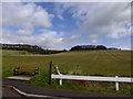
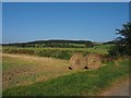
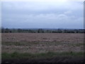
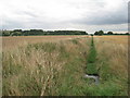
20 photos from this area
Area Information
Key information about the DN20 0PY including its size, population, and administrative classification.
- Area Type
- Postcode
- Area Size
- 62.7 hectares
- Population
- 1207
- Population Density
- 41 people/km²
House Prices in DN20 0PY
25
Properties
£162,917
Average Sold Price
£46,000
Lowest Price
£400,000
Highest Price
Showing 25 properties
| Address | Type | Beds | Baths | Last Sale Price | Last Sale Date | |
|---|---|---|---|---|---|---|
| Childerstones, 67 Main Street, Bonby, DN20 0PY | Detached | 4 | 2 | £400,000 | Apr 2024 | |
| Copper Beech, Main Street, Bonby, DN20 0PY | Bungalow | 2 | 1 | £197,000 | Mar 2020 | |
| 105 Main Street, Bonby, DN20 0PY | Semi-detached | 3 | 1 | £190,000 | Jan 2020 | |
| Manor Farm, 99 Main Street, Bonby, DN20 0PY | Terraced | - | - | £97,000 | Nov 2005 | |
| 87 Main Street, Bonby, DN20 0PY | Semi-detached | - | - | £46,000 | Nov 2001 | |
| 111-113 Main Street, Bonby, DN20 0PY | house | - | - | £47,500 | Sep 1997 | |
| Carr Lodge, 107 Main Street, Bonby, DN20 0PY | Bungalow | 3 | 1 | - | - | |
| Flat, The Haymaker, 75 Main Street, Bonby, DN20 0PY | Land | 4 | 1 | - | - | |
| 123 Main Street, Bonby, DN20 0PY | Land | - | - | - | - | |
| North End, 121 Main Street, Bonby, DN20 0PY | Bungalow | 4 | 3 | - | - |
Page 1 of 3
Energy Efficiency in DN20 0PY
Amenities
Schools
| Rank | School | Type | Entry gender | Ages |
|---|
Explore more schools in this area
Go to Schools tabDemographics
Household Size
Two person
most common
Accommodation Type
Houses
most common
Tenure
70
majority
Ethnic Group
White
most common
Religion
N/A
most common
Household Composition
N/A
most common
Age
47
median
Adults (30-64 years)
most common
Household Deprivation
N/A
with no deprivation
NS-SEC
34
in Lower managerial occupations
Explore more demographic insights in this area
Go to Demographics tabPlanning
Planning Constraints
- Flood RiskPremium
- Ramsar Wetland SitesPremium
- Area of Outstanding Natural BeautyPremium
- Protected Nature ReservePremium
- Protected WoodlandPremium