Area Overview for DN20 0PS
Photos of DN20 0PS
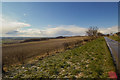
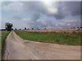
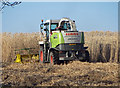
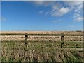
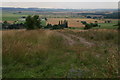
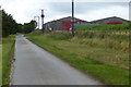
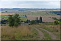
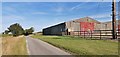
81 photos from this area
Area Information
Key information about the DN20 0PS including its size, population, and administrative classification.
- Area Type
- Postcode
- Area Size
- 95.6 hectares
- Population
- 1207
- Population Density
- 41 people/km²
House Prices in DN20 0PS
24
Properties
£238,464
Average Sold Price
£60,000
Lowest Price
£550,000
Highest Price
Showing 24 properties
| Address | Type | Beds | Baths | Last Sale Price | Last Sale Date | |
|---|---|---|---|---|---|---|
| Tudor Rose, 6 Church Lane, Bonby, DN20 0PS | Bungalow | - | - | £287,000 | Jul 2022 | |
| 28 Church Lane, Bonby, DN20 0PS | Detached | 5 | 3 | £550,000 | Apr 2022 | |
| 14 Church Lane, Bonby, DN20 0PS | Retail | 3 | 2 | £205,000 | Feb 2019 | |
| 2 Church Lane, Bonby, DN20 0PS | Detached | 4 | 2 | £310,000 | Oct 2018 | |
| Hunters Moon, 4 Church Lane, Bonby, DN20 0PS | Bungalow | 2 | 1 | £192,000 | Aug 2017 | |
| 5 Church Lane, Bonby, DN20 0PS | Bungalow | 2 | 1 | £178,000 | Jul 2017 | |
| Tree Tops, 26 Church Lane, Bonby, DN20 0PS | Bungalow | 3 | - | £287,000 | Oct 2016 | |
| 34 Church Lane, Bonby, DN20 0PS | house | - | - | £390,000 | Sep 2016 | |
| Sycamore Lodge, 22 Church Lane, Bonby, DN20 0PS | Detached | 3 | - | £210,000 | Apr 2014 | |
| 2A Church Lane, Bonby, DN20 0PS | Detached | 4 | - | £300,000 | Jun 2013 |
Page 1 of 3
Energy Efficiency in DN20 0PS
Amenities
Schools
| Rank | School | Type | Entry gender | Ages |
|---|
Explore more schools in this area
Go to Schools tabDemographics
Household Size
Two person
most common
Accommodation Type
Houses
most common
Tenure
70
majority
Ethnic Group
White
most common
Religion
N/A
most common
Household Composition
N/A
most common
Age
47
median
Adults (30-64 years)
most common
Household Deprivation
N/A
with no deprivation
NS-SEC
34
in Lower managerial occupations
Explore more demographic insights in this area
Go to Demographics tabPlanning
Planning Constraints
- Flood RiskPremium
- Ramsar Wetland SitesPremium
- Area of Outstanding Natural BeautyPremium
- Protected Nature ReservePremium
- Protected WoodlandPremium