Area Overview for DN20 0LB
Photos of DN20 0LB
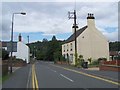
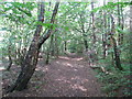
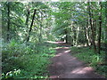
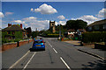
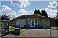
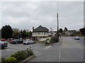
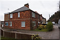
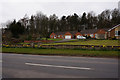
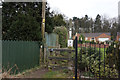
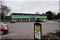
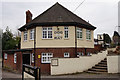
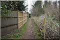
38 photos from this area
Area Information
Key information about the DN20 0LB including its size, population, and administrative classification.
- Area Type
- Postcode
- Area Size
- 3.3 hectares
- Population
- 1595
- Population Density
- 2364 people/km²
House Prices in DN20 0LB
42
Properties
£107,042
Average Sold Price
£9,000
Lowest Price
£175,000
Highest Price
Showing 42 properties
| Address | Type | Beds | Baths | Last Sale Price | Last Sale Date | |
|---|---|---|---|---|---|---|
| 75 George Street, Broughton, DN20 0LB | Semi-detached | 3 | 1 | £175,000 | Nov 2024 | |
| 11 George Street, Broughton, DN20 0LB | Terraced | 4 | 1 | £157,000 | Apr 2024 | |
| 5 George Street, Broughton, DN20 0LB | Semi-detached | 1 | - | £69,000 | Sep 2020 | |
| 17 George Street, Broughton, DN20 0LB | house | - | - | £110,000 | Apr 2020 | |
| 29 George Street, Broughton, DN20 0LB | Semi-detached | 3 | 1 | £136,000 | Dec 2019 | |
| 21 George Street, Broughton, DN20 0LB | house | - | - | £118,000 | Jul 2019 | |
| 51 George Street, Broughton, DN20 0LB | Terraced | 3 | 1 | £119,000 | Jan 2019 | |
| The First House, George Street, Broughton, DN20 0LB | Detached | 3 | 1 | £153,000 | Nov 2018 | |
| 31 George Street, Broughton, DN20 0LB | house | - | - | £135,000 | Jan 2018 | |
| 9 George Street, Broughton, DN20 0LB | house | 3 | 1 | £118,000 | Feb 2017 |
Page 1 of 5
Energy Efficiency in DN20 0LB
Amenities
Schools
| Rank | School | Type | Entry gender | Ages |
|---|
Explore more schools in this area
Go to Schools tabDemographics
Household Size
Two person
most common
Accommodation Type
Houses
most common
Tenure
67
majority
Ethnic Group
White
most common
Religion
N/A
most common
Household Composition
N/A
most common
Age
47
median
Adults (30-64 years)
most common
Household Deprivation
N/A
with no deprivation
NS-SEC
26
in Lower managerial occupations
Explore more demographic insights in this area
Go to Demographics tabPlanning
Planning Constraints
- Flood RiskPremium
- Ramsar Wetland SitesPremium
- Area of Outstanding Natural BeautyPremium
- Protected Nature ReservePremium
- Protected WoodlandPremium