Area Overview for DN20 0JY
Photos of DN20 0JY
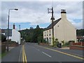
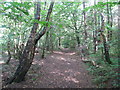
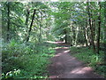
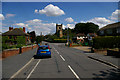
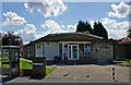
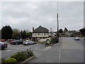
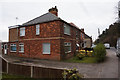
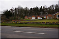
38 photos from this area
Area Information
Key information about the DN20 0JY including its size, population, and administrative classification.
- Area Type
- Postcode
- Area Size
- 1.8 hectares
- Population
- 1474
- Population Density
- 446 people/km²
House Prices in DN20 0JY
31
Properties
£118,780
Average Sold Price
£32,500
Lowest Price
£185,000
Highest Price
Showing 31 properties
| Address | Type | Beds | Baths | Last Sale Price | Last Sale Date | |
|---|---|---|---|---|---|---|
| 22 Estate Avenue, Broughton, DN20 0JY | Semi-detached | 3 | 1 | £185,000 | Oct 2025 | |
| 35 Estate Avenue, Broughton, DN20 0JY | Semi-detached | 3 | 1 | £171,500 | Aug 2025 | |
| 23 Estate Avenue, Broughton, DN20 0JY | Semi-detached | 3 | 1 | £142,000 | Jul 2025 | |
| 9 Estate Avenue, Broughton, DN20 0JY | house | 3 | 1 | £169,950 | May 2025 | |
| 29 Estate Avenue, Broughton, DN20 0JY | Semi-detached | 3 | 1 | £178,000 | Jun 2023 | |
| 7 Estate Avenue, Broughton, DN20 0JY | Semi-detached | 3 | 1 | £162,000 | Jul 2022 | |
| 14 Estate Avenue, Broughton, DN20 0JY | Semi-detached | 3 | - | £154,000 | Jul 2022 | |
| 18 Estate Avenue, Broughton, DN20 0JY | house | 3 | 1 | £185,000 | Jun 2022 | |
| 24 Estate Avenue, Broughton, DN20 0JY | Semi-detached | 3 | 1 | £163,500 | Mar 2021 | |
| 8 Estate Avenue, Broughton, DN20 0JY | house | - | - | £141,500 | Jun 2019 |
Page 1 of 4
Energy Efficiency in DN20 0JY
Amenities
Schools
| Rank | School | Type | Entry gender | Ages |
|---|
Explore more schools in this area
Go to Schools tabDemographics
Household Size
Two person
most common
Accommodation Type
Houses
most common
Tenure
86
majority
Ethnic Group
White
most common
Religion
N/A
most common
Household Composition
N/A
most common
Age
47
median
Adults (30-64 years)
most common
Household Deprivation
N/A
with no deprivation
NS-SEC
31
in Lower managerial occupations
Explore more demographic insights in this area
Go to Demographics tabPlanning
Planning Constraints
- Flood RiskPremium
- Ramsar Wetland SitesPremium
- Area of Outstanding Natural BeautyPremium
- Protected Nature ReservePremium
- Protected WoodlandPremium