Area Overview for DN20 0ED
Photos of DN20 0ED

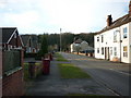
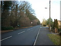
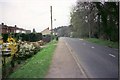
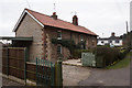
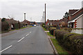
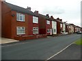
31 photos from this area
Area Information
Key information about the DN20 0ED including its size, population, and administrative classification.
- Area Type
- Postcode
- Area Size
- 1.7 hectares
- Population
- 1595
- Population Density
- 2364 people/km²
House Prices in DN20 0ED
45
Properties
£92,700
Average Sold Price
£25,000
Lowest Price
£158,000
Highest Price
Showing 45 properties
| Address | Type | Beds | Baths | Last Sale Price | Last Sale Date | |
|---|---|---|---|---|---|---|
| 33 Brooklands Avenue, Broughton, DN20 0ED | Terraced | 3 | 2 | £158,000 | Mar 2025 | |
| 132 Brooklands Avenue, Broughton, DN20 0ED | Semi-detached | 3 | 1 | £140,000 | Aug 2023 | |
| 110 Brooklands Avenue, Broughton, DN20 0ED | house | - | - | £145,000 | Dec 2022 | |
| 29 Brooklands Avenue, Broughton, DN20 0ED | Flat | 2 | 1 | £118,000 | Oct 2022 | |
| 120 Brooklands Avenue, Broughton, DN20 0ED | Semi-detached | 2 | 1 | £110,000 | Jul 2019 | |
| 114 Brooklands Avenue, Broughton, DN20 0ED | Semi-detached | 2 | 2 | £125,000 | Feb 2019 | |
| 75 Brooklands Avenue, Broughton, DN20 0ED | Semi-detached | 2 | 1 | £88,000 | Nov 2018 | |
| 45 Brooklands Avenue, Broughton, DN20 0ED | Semi-detached | 3 | 1 | £127,000 | Jul 2018 | |
| 35 Brooklands Avenue, Broughton, DN20 0ED | Terraced | 2 | 1 | £73,000 | Jun 2018 | |
| 126 Brooklands Avenue, Broughton, DN20 0ED | Semi-detached | 2 | 1 | £112,000 | Feb 2018 |
Page 1 of 5
Energy Efficiency in DN20 0ED
Amenities
Schools
| Rank | School | Type | Entry gender | Ages |
|---|
Explore more schools in this area
Go to Schools tabDemographics
Household Size
Two person
most common
Accommodation Type
Houses
most common
Tenure
67
majority
Ethnic Group
White
most common
Religion
N/A
most common
Household Composition
N/A
most common
Age
47
median
Adults (30-64 years)
most common
Household Deprivation
N/A
with no deprivation
NS-SEC
26
in Lower managerial occupations
Explore more demographic insights in this area
Go to Demographics tabPlanning
Planning Constraints
- Flood RiskPremium
- Ramsar Wetland SitesPremium
- Area of Outstanding Natural BeautyPremium
- Protected Nature ReservePremium
- Protected WoodlandPremium