Area Overview for DN18 6EL
Photos of DN18 6EL


Area Information
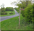
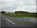
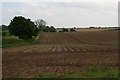
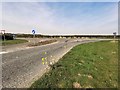
DN18 6EL is a small, residential postcode area in England covering 57.5 hectares with a population of 1,866 people. Its low population density of 97 people per square kilometre suggests a quiet, spread-out community rather than a densely packed urban environment. The area is home to a mix of families and long-term residents, with a median age of 47 and most residents falling within the 30–64 age range. This demographic profile indicates a stable, mature population, likely with established careers and family ties. Daily life here is shaped by proximity to local amenities, including five retail outlets like Asda Barton-Upon and Lidl Barton-upon, as well as five railway stations offering connections to nearby towns. The area’s broadband score of 95 and mobile coverage of 82 ensure reliable digital connectivity, supporting both remote work and everyday internet use. With no major environmental constraints or flood risks, DN18 6EL offers a low-stress, practical living environment for those prioritising safety, convenience, and a slower pace of life.
- Area Type
- Postcode
- Area Size
- 57.5 hectares
- Population
- 1866
- Population Density
- 97 people/km²
DN18 6EL is primarily an owner-occupied area, with 86% of properties in private hands. This high rate of home ownership suggests a community of long-term residents rather than a transient rental market. The accommodation type is predominantly houses, which aligns with the area’s low population density and suburban character. This housing stock implies a focus on family homes, semi-detached properties, or larger plots, which may appeal to buyers seeking space and privacy. Given the area’s small size—just 57.5 hectares—properties are likely to be spread out, reducing competition for housing but also limiting the range of options available. The lack of flats or apartments means the market is not geared toward younger buyers or those prioritising urban living. For those considering purchase, the stability of home ownership and the absence of planning constraints or environmental risks make DN18 6EL a practical choice, though the limited scale of the area may restrict opportunities for investment or development.
House Prices in DN18 6EL
Showing 7 properties
Energy Efficiency in DN18 6EL
Residents of DN18 6EL have access to a range of nearby amenities within practical reach. The area includes five retail outlets, such as Asda Barton-Upon, Lidl Barton-upon, and Spar, providing everyday shopping and convenience. Five railway stations offer regular transport links, while two airports—both Humberside Airport—cater to regional travel needs. Though the data does not mention parks or leisure facilities, the absence of environmental constraints like protected woodlands or AONB designations suggests open spaces may be available for recreation. The mix of retail, transport, and travel options contributes to a functional lifestyle, where daily errands and commuting are manageable without long journeys. The presence of multiple rail stations also implies a degree of connectivity to larger urban centres, allowing residents to access cultural or professional opportunities beyond the immediate area. This balance of practical amenities and accessibility makes DN18 6EL suitable for those seeking a self-contained yet connected lifestyle.
Amenities
Schools
The nearest school to DN18 6EL is Bowmandale Primary School, which holds an Ofsted rating of outstanding. This indicates a high standard of education for younger children, though no secondary schools are listed in the data. The presence of a primary school with an excellent rating is a significant draw for families with young children, as it suggests reliable teaching quality and facilities. However, the absence of secondary schools nearby may require students to commute to neighbouring areas for further education. The school’s proximity to the area reinforces its appeal as a family-friendly location, where parents can access high-quality early education without long commutes. For those prioritising school performance, Bowmandale Primary’s rating is a clear advantage, though further research would be needed to confirm the availability of secondary education options within a reasonable distance.
| Rank | School | Type | Entry gender | Ages |
|---|
Explore more schools in this area
Go to Schools tabDemographics
The community in DN18 6EL is predominantly composed of adults aged 30–64, reflecting a mature population with a median age of 47. Home ownership is high at 86%, indicating a stable, long-term resident base rather than a transient rental market. The area is characterised by houses rather than flats, suggesting a focus on family-friendly or semi-detached living. The predominant ethnic group is White, with no specific data on other demographics provided. The population density of 97 people per square kilometre means the area is not overcrowded, contributing to a relaxed, low-pressure environment. This combination of factors—high home ownership, a mature age profile, and a residential focus—creates a community where neighbours are likely to know one another, and local amenities serve a consistent, localised demand. The absence of significant deprivation indicators suggests a generally comfortable standard of living, though specific data on income levels or social mobility is not available.
Household Size
Accommodation Type
Tenure
Ethnic Group
Religion
Household Composition
Age
Household Deprivation
NS-SEC
Explore more demographic insights in this area
Go to Demographics tabPlanning
Planning Constraints
- Flood RiskPremium
- Ramsar Wetland SitesPremium
- Area of Outstanding Natural BeautyPremium
- Protected Nature ReservePremium
- Protected WoodlandPremium