Area Overview for DN18 6BA
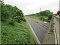
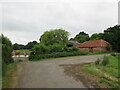
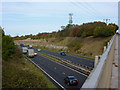
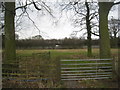
Photos of DN18 6BA


Area Information
DN18 6BA is a small, tightly knit residential postcode area in England, covering 7.7 km² with a population of 1866. Its low density of 97 people per square kilometre suggests a quiet, spread-out community, likely centred around family homes. The area’s demographic profile indicates a mature population, with a median age of 47 and the majority of residents aged 30–64. This suggests a stable, established community with strong ties to local amenities. Daily life here is likely characterised by a balance between domestic routines and access to nearby services. The presence of rail stations such as Barton and Hessle, combined with retail options like Asda and Lidl, points to a practical, convenience-driven lifestyle. While the area is small, it offers a mix of residential tranquillity and functional connectivity, making it appealing to those seeking a settled environment without the pressures of urban density.
- Area Type
- Postcode
- Area Size
- 7.7 km²
- Population
- 1866
- Population Density
- 97 people/km²
The property market in DN18 6BA is characterised by high home ownership, with 86% of residents owning their homes. This suggests a stable, owner-occupied market rather than a rental-focused one. The predominant accommodation type is houses, which is typical of areas with low population density and a focus on family living. Given the small size of the postcode area, the housing stock is likely limited, meaning buyers should consider the immediate surrounding areas for more options. The presence of houses rather than flats or apartments indicates a preference for larger, more private properties, which may appeal to families or those seeking long-term residency. For buyers, this market offers a chance to invest in established homes, though the limited supply could mean competition for available properties.
House Prices in DN18 6BA
Showing 17 properties
| Address | Type | Beds | Baths | Last Sale Price | Last Sale Date | |
|---|---|---|---|---|---|---|
| Barton Hill Farm, Access To Barton Hill Farm Off B 1218, Barton Upon Humber, DN18 6BA | Detached | 5 | 4 | £1,000,000 | Jun 2018 | |
| Field Farm Bungalow, Brigg Road, Barton Upon Humber, DN18 6BA | Bungalow | - | - | £250,000 | Oct 2016 | |
| Lea Farm, Brigg Road, Barton Upon Humber, DN18 6BA | Detached | 3 | 2 | - | - | |
| Chapel Farm, Brigg Road, Barton Upon Humber, DN18 6BA | Detached | 6 | - | - | - | |
| White Hart Farm, Brigg Road, Barton Upon Humber, DN18 6BA | house | 3 | 2 | - | - | |
| White Hart Cottage, Brigg Road, Barton Upon Humber, DN18 6BA | Semi-detached | - | - | - | - | |
| The Cottage Chapel Farm, Access Road To Chapel Farm, Barton Upon Humber, DN18 6BA | Semi-detached | - | - | - | - | |
| White House Farm, Brigg Road, Barton Upon Humber, DN18 6BA | Detached | - | - | - | - | |
| Annexe, Lea Farm, Brigg Road, Barton Upon Humber, DN18 6BA | Flat | - | - | - | - | |
| The Stables, Brigg Road, Barton Upon Humber, DN18 6BA | Bungalow | - | - | - | - |
Energy Efficiency in DN18 6BA
Living in DN18 6BA offers access to a range of nearby amenities within practical reach. Retail options include Asda Barton-Upon, Lidl Barton-upon, and Spar, providing essential shopping and convenience services. The presence of five retail outlets suggests a functional local economy, supporting daily needs without requiring long journeys. Rail stations such as Barton and Hessle further enhance connectivity, enabling residents to travel to nearby towns for additional leisure, dining, or employment opportunities. While the area’s small size means amenities are limited to the immediate vicinity, the combination of retail and transport options creates a lifestyle that balances convenience with the tranquillity of a smaller community. This setup is ideal for those who prioritise accessibility without the hustle of a larger urban environment.
Amenities
Schools
The nearest school to DN18 6BA is Bowmandale Primary School, which holds an outstanding Ofsted rating. As a primary school, it serves the needs of local families with young children, offering a high standard of education. The absence of secondary schools in the immediate area means families may need to consider nearby towns for secondary education, but the outstanding rating at Bowmandale Primary provides reassurance for those prioritising early education. The school’s performance is a key factor for families seeking a reliable educational foundation, and its proximity to the area enhances its appeal. With no other schools listed in the data, the focus remains on primary education as the primary school option for DN18 6BA residents.
| Rank | School | Type | Entry gender | Ages |
|---|
Explore more schools in this area
Go to Schools tabDemographics
The community in DN18 6BA is predominantly composed of adults aged 30–64, with a median age of 47. This age group makes up the majority of residents, reflecting a mature, stable population. Home ownership is high at 86%, indicating a strong presence of long-term residents and a focus on property as an investment. The accommodation type is primarily houses, which aligns with the area’s low population density and suggests a preference for family-oriented living. The predominant ethnic group is White, with no specific data provided on other demographics. The low population density of 97 people per km² implies a less crowded environment, which can contribute to a sense of privacy and space. For quality of life, this profile suggests a community where residents are likely to have established careers, family commitments, and a strong connection to local infrastructure.
Household Size
Accommodation Type
Tenure
Ethnic Group
Religion
Household Composition
Age
Household Deprivation
NS-SEC
Explore more demographic insights in this area
Go to Demographics tabPlanning
Planning Constraints
- Flood RiskPremium
- Ramsar Wetland SitesPremium
- Area of Outstanding Natural BeautyPremium
- Protected Nature ReservePremium
- Protected WoodlandPremium