Area Overview for DN18 6EE
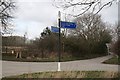
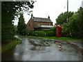
Photos of DN18 6EE


Area Information
DN18 6EE is a small residential cluster in England, covering 2.6 km² with a population of 1610 people. Its low population density of 36 people per square kilometre suggests a quiet, spread-out community. The area is predominantly home to owner-occupiers, with 73% of households owning their homes. Most properties are houses, reflecting a traditional, family-oriented settlement. The median age of 47 indicates a mature demographic, with adults aged 30–64 forming the largest group. This suggests a stable, long-term community with established local ties. Residents benefit from low crime risk, with a safety score of 77 out of 100, and no significant environmental hazards like flood zones or protected landscapes. Daily life in DN18 6EE is characterised by proximity to essential services, including primary schools, rail links, and retail outlets. The area’s small size means it is likely to feel close-knit, though its limited scale may require residents to travel slightly for specialist amenities. For those seeking a peaceful, low-maintenance lifestyle with a sense of security, DN18 6EE offers a straightforward, unpretentious living environment.
- Area Type
- Postcode
- Area Size
- 2.6 km²
- Population
- 1610
- Population Density
- 36 people/km²
DN18 6EE is primarily an owner-occupied area, with 73% of homes owned by their residents. The accommodation type is predominantly houses, which is typical of smaller rural or semi-rural settlements. This suggests a market focused on family homes rather than flats or rental properties, which may appeal to buyers seeking long-term stability. The small size of the area—just 2.6 km²—means the housing stock is limited, and buyers may need to consider nearby regions for more options. The high home ownership rate indicates a low turnover of properties, which can contribute to a steady, predictable market. However, the lack of rental properties may make it less attractive to those seeking short-term or investment opportunities. For those prioritising a traditional, low-maintenance lifestyle, the predominance of houses in DN18 6EE aligns with a preference for private, spacious living. The area’s compact nature also means property values may be influenced more by proximity to local amenities than by broader regional trends.
House Prices in DN18 6EE
Showing 8 properties
| Address | Type | Beds | Baths | Last Sale Price | Last Sale Date | |
|---|---|---|---|---|---|---|
| Burnham Cottage, Barton Road, Burnham, DN18 6EE | Detached | - | - | £240,000 | May 2007 | |
| Laburnum House, Thornton Curtis Road, Burnham, DN18 6EE | Detached | - | - | £155,000 | Oct 2002 | |
| Burnham Grange, 1 Barton Road, Burnham, DN18 6EE | house | - | - | - | - | |
| Field House Burnham Grange, Barton Road, Burnham, DN18 6EE | house | - | - | - | - | |
| Sycamore House, Thornton Curtis Road, Burnham, DN18 6EE | house | - | - | - | - | |
| Burnham Grange, 2 Barton Road, Burnham, DN18 6EE | house | - | - | - | - | |
| Burnham Grange, Barton Road, Burnham, DN18 6EE | Detached | - | - | - | - | |
| Burnham Manor, Barton Road, Burnham, DN18 6EE | house | - | - | - | - |
Energy Efficiency in DN18 6EE
The lifestyle in DN18 6EE is shaped by its proximity to essential amenities, though the selection is modest. Retail options include Co-op Barrow upon, Co-op Barton, and Spar, providing basic grocery and convenience services. These shops cater to daily needs but may not offer the range found in larger towns. The area’s rail stations—Barton, Thornton Abbey, and Goxhill—connect residents to broader networks, enabling travel to nearby hubs for leisure, shopping, or employment. The presence of Humberside Airport, though not detailed in terms of frequency, offers regional flight access. While the area lacks dedicated parks or leisure facilities, the rail links and nearby retail options contribute to a functional, if unadorned, lifestyle. The compact nature of DN18 6EE means residents must balance convenience with the need to travel for more specialised amenities, but the available services support a self-sufficient, community-oriented way of life.
Amenities
Schools
Residents of DN18 6EE have access to two primary schools within practical reach: East Halton Primary School and Ulceby St Nicholas Church of England Primary School. The latter is listed twice in the data, but both schools are primary institutions with one holding a ‘good’ Ofsted rating. This mix of school types provides families with options for their children’s early education. The presence of two primary schools suggests a focus on local, community-based learning, which can be beneficial for parents seeking a familiar, accessible environment for their children. However, the absence of secondary schools or further education facilities in the immediate area means families may need to travel for older children’s schooling. The ‘good’ rating at Ulceby St Nicholas indicates a school with strong performance, which could be a significant draw for families prioritising quality education. Overall, the availability of primary schools supports the area’s appeal to families with young children.
| Rank | School | Type | Entry gender | Ages |
|---|
Explore more schools in this area
Go to Schools tabDemographics
The population of DN18 6EE is 1610, with a median age of 47, reflecting a mature demographic. The largest age group is adults aged 30–64, comprising the majority of residents. Home ownership is high at 73%, indicating a strong presence of long-term residents and a stable housing market. The predominant accommodation type is houses, which aligns with the area’s traditional character and suggests a focus on family homes. The predominant ethnic group is White, though no specific data on diversity or deprivation is provided. The low population density of 36 people per square kilometre implies a more spacious, less crowded environment compared to urban areas. This demographic profile suggests a community that values stability and familiarity, with fewer transient populations. The absence of detailed data on deprivation means it is unclear how socioeconomic factors might influence quality of life, but the high home ownership rate and low crime risk suggest a generally secure and self-sufficient population.
Household Size
Accommodation Type
Tenure
Ethnic Group
Religion
Household Composition
Age
Household Deprivation
NS-SEC
Explore more demographic insights in this area
Go to Demographics tabPlanning
Planning Constraints
- Flood RiskPremium
- Ramsar Wetland SitesPremium
- Area of Outstanding Natural BeautyPremium
- Protected Nature ReservePremium
- Protected WoodlandPremium