Area Overview for DN18 6AA
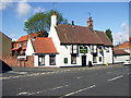
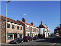
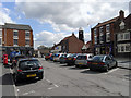
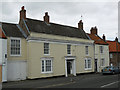
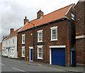
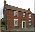
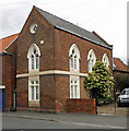
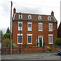
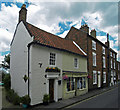
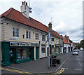
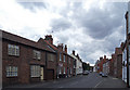
Photos of DN18 6AA

Area Information
Living in DN18 6AA means inhabiting a tightly compact residential cluster in England, where 2,066 people reside across just 1.7 hectares. The area’s high population density of 122,103 people per square kilometre reflects its small, densely populated nature, typical of rural clusters with limited expansion. This postcode is characterised by a mature community, with a median age of 47 and a majority of residents aged 30–64. The housing stock here is predominantly owner-occupied, with 69% of homes owned by residents, and the accommodation is largely composed of houses rather than flats. Daily life is shaped by proximity to essential services, including five retail outlets like Co-op Barton and Morrisons Daily Barton-on, and five rail stations within reach, including Barton and Hessle. The area’s compact size means amenities are close, but its small footprint also means it is a niche, self-contained community. For buyers, this is a place where convenience and a sense of local identity are prioritised, though the limited space may not suit those seeking larger properties or extensive green spaces.
- Area Type
- Postcode
- Area Size
- 1.7 hectares
- Population
- 2066
- Population Density
- 2857 people/km²
The property market in DN18 6AA is dominated by owner-occupied homes, with 69% of properties owned by residents. This suggests a community prioritising long-term residence over rental investment. The accommodation is almost exclusively houses, rather than flats or apartments, which may appeal to buyers seeking family-friendly, single-unit properties. Given the area’s small size of 1.7 hectares, the housing stock is limited, and the high population density indicates that properties are likely to be in close proximity to one another. For buyers, this means a compact, self-contained area with a clear focus on residential living. However, the limited space may restrict availability of larger homes or properties with extensive outdoor space. The market is likely to be competitive, with demand driven by the area’s proximity to rail links and essential services, though the small footprint means buyers should consider whether the community’s size aligns with their needs.
House Prices in DN18 6AA
Showing 29 properties
| Address | Type | Beds | Baths | Last Sale Price | Last Sale Date | |
|---|---|---|---|---|---|---|
| 23 Barrow Road, Barton Upon Humber, DN18 6AA | Terraced | 2 | 1 | £135,000 | Sep 2025 | |
| 4 Barrow Road, Barton Upon Humber, DN18 6AA | Detached | 4 | 2 | £330,000 | Jul 2025 | |
| 6 Barrow Road, Barton Upon Humber, DN18 6AA | Bungalow | 3 | 1 | £245,000 | Nov 2024 | |
| 21 Barrow Road, Barton Upon Humber, DN18 6AA | Terraced | 3 | 1 | £118,000 | Dec 2023 | |
| 13 Barrow Road, Barton Upon Humber, DN18 6AA | Terraced | 3 | 1 | £110,000 | Sep 2021 | |
| 9 Barrow Road, Barton Upon Humber, DN18 6AA | house | - | - | £120,000 | Apr 2021 | |
| 12 Barrow Road, Barton Upon Humber, DN18 6AA | Bungalow | - | - | £183,000 | Jan 2021 | |
| 11 Barrow Road, Barton Upon Humber, DN18 6AA | Terraced | 3 | 1 | £63,000 | Nov 2019 | |
| 37 Barrow Road, Barton Upon Humber, DN18 6AA | Semi-detached | 3 | 1 | £124,000 | Aug 2018 | |
| 7 Barrow Road, Barton Upon Humber, DN18 6AA | Terraced | 3 | 1 | £90,000 | Sep 2017 |
Energy Efficiency in DN18 6AA
Daily life in DN18 6AA is shaped by its proximity to essential amenities, including five retail outlets such as Co-op Barton, Morrisons Daily Barton-on, and Spar. These shops provide convenience for grocery shopping and everyday needs, reducing the need for long trips to larger towns. The area’s rail network, with stations like Barton and Hessle, offers easy access to broader regional services, while Brough Airport provides regional flight connections. Although there are no parks or leisure facilities explicitly listed in the data, the compact residential cluster suggests a focus on local, community-based living. The mix of retail, rail, and air connectivity creates a lifestyle where convenience and accessibility are prioritised, though the small area may limit options for outdoor recreation or expansive leisure spaces. For residents, this means a self-contained environment where essential services are close, but expansion beyond the immediate vicinity is necessary for more diverse activities.
Amenities
Schools
The nearest school to DN18 6AA is Barton St Peter’s CofE Primary School, which provides education for younger children and holds an Ofsted rating of ‘good’. This primary school is a key asset for families with young children, offering a locally based educational option. The absence of secondary schools in the immediate vicinity means students may need to travel to nearby towns for further education, though the rail network, including stations like Barton and Hessle, facilitates such commutes. The presence of a well-rated primary school enhances the area’s appeal for families, ensuring children have access to quality early education without long distances. For parents, this school’s ‘good’ rating indicates a reliable, standards-compliant institution, though the lack of higher-tier schools nearby may be a consideration for those planning for long-term educational needs.
| Rank | School | Type | Entry gender | Ages |
|---|
Explore more schools in this area
Go to Schools tabDemographics
The community in DN18 6AA is defined by its age profile, with a median age of 47 and a majority of residents aged 30–64. This suggests a population skewed towards middle-aged adults, likely with established careers and families. Home ownership is strong, with 69% of properties owned by residents, indicating a stable, long-term community. The accommodation is almost entirely composed of houses, reflecting a preference for single-family dwellings over flats or apartments. The predominant ethnic group is White, though specific diversity figures are not provided. The population density of 122,103 people per square kilometre implies a tightly packed residential area, which may influence social dynamics and access to shared spaces. For quality of life, the high home ownership rate and mature age profile suggest a community with a focus on stability, though the limited area may mean fewer amenities per capita compared to larger towns.
Household Size
Accommodation Type
Tenure
Ethnic Group
Religion
Household Composition
Age
Household Deprivation
NS-SEC
Explore more demographic insights in this area
Go to Demographics tabPlanning
Planning Constraints
- Flood RiskPremium
- Ramsar Wetland SitesPremium
- Area of Outstanding Natural BeautyPremium
- Protected Nature ReservePremium
- Protected WoodlandPremium