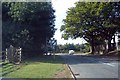
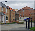
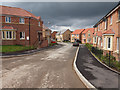
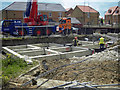
Area Overview for DN18 5NE
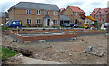
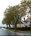
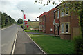
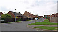
Photos of DN18 5NE

Area Information
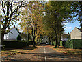
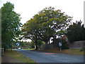
DN18 5NE is a small residential postcode area in England, covering 9,142 square metres and home to 1,866 residents. Its low population density of 97 people per square kilometre suggests a quiet, spacious living environment, typical of a small cluster of homes. The area is characterised by a mix of older and newer housing stock, with a strong emphasis on owner-occupied properties. Daily life here is likely to be low-key, with a focus on local amenities and community ties. The proximity to Barton-upon-Humber and nearby towns offers access to broader services, while the area’s compact size ensures a sense of familiarity. With a median age of 47 and a population skewed towards adults aged 30–64, the community is stable and family-oriented. This is not a high-density urban area, but one where residents can expect a balance between privacy and accessibility. The absence of major environmental constraints, such as protected nature reserves or AONB designations, means development is unlikely to be restricted, though the area remains largely residential. For those seeking a peaceful, low-maintenance lifestyle, DN18 5NE offers a straightforward, uncluttered alternative to busier regions.
- Area Type
- Postcode
- Area Size
- 9142 m²
- Population
- 1866
- Population Density
- 97 people/km²
DN18 5NE is a predominantly owner-occupied area, with 86% of homes owned by residents rather than rented. The accommodation type is primarily houses, which is unusual for a small postcode area but may reflect a mix of detached or semi-detached properties. This suggests a housing stock that is likely to be older, with limited new developments, and possibly more spacious than typical urban settings. The compact size of the area means the property market is limited in scale, with few options available for buyers. However, the high home ownership rate indicates that properties are likely to be held long-term, which could make the market less dynamic. For buyers, this means competition may be limited, but the range of properties could be narrow. The focus on houses rather than flats also implies that the area may appeal to those seeking larger, more private living spaces.
House Prices in DN18 5NE
Showing 10 properties
| Address | Type | Beds | Baths | Last Sale Price | Last Sale Date | |
|---|---|---|---|---|---|---|
| 12 Forkedale, Barton Upon Humber, DN18 5NE | Bungalow | 2 | - | £163,000 | Jun 2014 | |
| 16 Forkedale, Barton Upon Humber, DN18 5NE | Detached | 3 | - | £155,000 | Aug 2012 | |
| 20 Forkedale, Barton Upon Humber, DN18 5NE | Detached | - | - | £161,500 | May 2006 | |
| 8 Forkedale, Barton Upon Humber, DN18 5NE | Detached | 3 | 1 | £117,500 | Jan 2003 | |
| 14 Forkedale, Barton Upon Humber, DN18 5NE | Bungalow | 2 | 1 | - | - | |
| 18 Forkedale, Barton Upon Humber, DN18 5NE | Bungalow | 2 | 1 | - | - | |
| 2 Forkedale, Barton Upon Humber, DN18 5NE | Detached | - | - | - | - | |
| 6 Forkedale, Barton Upon Humber, DN18 5NE | Detached | - | - | - | - | |
| 4 Forkedale, Barton Upon Humber, DN18 5NE | house | - | - | - | - | |
| 10 Forkedale, Barton Upon Humber, DN18 5NE | Detached | - | - | - | - |
Energy Efficiency in DN18 5NE
The lifestyle in DN18 5NE is shaped by its proximity to essential retail and transport hubs. Nearby shops include Lidl Barton-upon, Asda Barton-Upon, and Spar, providing access to everyday groceries and convenience services. These retail options are within practical reach, supporting a self-sufficient local economy. The area’s rail connections, including Barton, Hessle Rail Stn, and Barrow Haven Railway Station, offer regular access to broader regional networks, making it easier to travel for work, shopping, or leisure. Brough Airport, though not a major international hub, adds to the area’s connectivity for those requiring air travel. While the data does not mention parks or leisure facilities, the presence of retail and transport options suggests a practical, functional lifestyle. Residents can expect a straightforward, no-frills environment where daily needs are met without the need for long commutes.
Amenities
Schools
The nearest school to DN18 5NE is Bowmandale Primary School, which has an outstanding Ofsted rating. This indicates a high standard of education for younger children, though no secondary schools are listed in the data. The presence of a primary school with an outstanding rating is a significant advantage for families with young children, as it suggests strong academic performance and supportive infrastructure. However, the absence of secondary schools means that students may need to travel to nearby towns for further education. For parents prioritising quality primary education, Bowmandale Primary School offers a compelling reason to consider the area. The lack of data on secondary schools means it is unclear whether the local education system extends beyond primary level, but the existing school provides a solid foundation for early years learning.
| Rank | School | Type | Entry gender | Ages |
|---|
Explore more schools in this area
Go to Schools tabDemographics
The population of DN18 5NE is predominantly middle-aged, with a median age of 47 and 86% of residents owning their homes. The majority of households are adults aged 30–64, indicating a community focused on stability and long-term residence. Home ownership is high, at 86%, suggesting a lack of rental properties and a preference for private ownership. The area is primarily composed of houses, rather than flats or apartments, which aligns with the low population density. The predominant ethnic group is White, though no specific data on diversity or deprivation is provided. This demographic profile implies a mature, settled population with limited turnover, which can contribute to a cohesive local identity. The absence of data on deprivation means it is unclear how socioeconomic factors might influence quality of life, but the high home ownership rate and age distribution suggest a relatively stable economic environment.
Household Size
Accommodation Type
Tenure
Ethnic Group
Religion
Household Composition
Age
Household Deprivation
NS-SEC
Explore more demographic insights in this area
Go to Demographics tabPlanning
Planning Constraints
- Flood RiskPremium
- Ramsar Wetland SitesPremium
- Area of Outstanding Natural BeautyPremium
- Protected Nature ReservePremium
- Protected WoodlandPremium