Area Overview for DN18 5AF
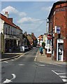
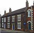
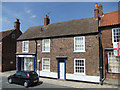
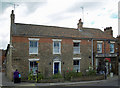
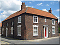
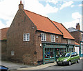
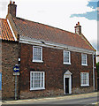
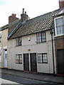
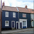
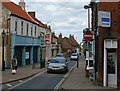
Photos of DN18 5AF
Area Information
DN18 5AF is a small, tightly knit residential area in England, covering just 1.7 hectares and home to 2,498 residents. Its compact size means the community is close-knit, with a population density of 2,472 people per square kilometre. This area is distinct for its stability, with a median age of 47 and a majority of residents aged 30–64. Daily life here is shaped by its proximity to essential services and transport links. The area’s low flood risk and safety score of 77/100 make it an attractive option for those prioritising security. While it lacks natural reserves or protected landscapes, its practical amenities—such as nearby rail stations and retail outlets—support a straightforward, functional lifestyle. Living in DN18 5AF suits those who value convenience, with homes predominantly in private ownership and a focus on local connectivity. The area’s small footprint means it’s ideal for buyers seeking a manageable, community-oriented environment without the sprawl of larger towns.
- Area Type
- Postcode
- Area Size
- 1.7 hectares
- Population
- 2498
- Population Density
- 2472 people/km²
The property market in DN18 5AF is dominated by owner-occupied homes, with 77% of properties in private hands. This high rate of home ownership suggests a community of long-term residents rather than a transient rental market. The accommodation type is primarily houses, which is unusual for areas with higher population density. This indicates a focus on single-family homes, possibly with larger gardens, despite the area’s small size. Buyers should note that the limited land area—just 1.7 hectares—means the housing stock is finite. The concentration of houses may appeal to those seeking traditional, stable properties but could also mean fewer options for buyers. Proximity to rail stations and retail hubs adds value, though the small footprint means the immediate surroundings are key to assessing property potential.
House Prices in DN18 5AF
Showing 19 properties
| Address | Type | Beds | Baths | Last Sale Price | Last Sale Date | |
|---|---|---|---|---|---|---|
| 20 Western Drive, Barton Upon Humber, DN18 5AF | Bungalow | 3 | 1 | £280,000 | Aug 2024 | |
| 12 Western Drive, Barton Upon Humber, DN18 5AF | Bungalow | 3 | 1 | £265,000 | May 2024 | |
| 10 Western Drive, Barton Upon Humber, DN18 5AF | Bungalow | 3 | 1 | £265,000 | May 2023 | |
| 18 Western Drive, Barton Upon Humber, DN18 5AF | Bungalow | 3 | 1 | £270,000 | Jan 2023 | |
| 13 Western Drive, Barton Upon Humber, DN18 5AF | Bungalow | - | - | £189,000 | Dec 2021 | |
| 5 Western Drive, Barton Upon Humber, DN18 5AF | Bungalow | - | - | £187,000 | Nov 2019 | |
| 22 Western Drive, Barton Upon Humber, DN18 5AF | Bungalow | 2 | 1 | £150,000 | Jul 2018 | |
| 16 Western Drive, Barton Upon Humber, DN18 5AF | Bungalow | 3 | 1 | £170,000 | Jul 2018 | |
| 6 Western Drive, Barton Upon Humber, DN18 5AF | Semi-detached | 2 | 2 | £95,000 | Jul 2016 | |
| 8 Western Drive, Barton Upon Humber, DN18 5AF | Bungalow | - | - | £130,000 | Mar 2016 |
Energy Efficiency in DN18 5AF
Living in DN18 5AF offers access to a range of practical amenities within reach. Retail options include Lidl Barton-upon, Asda Barton-Upon, and Spar, providing everyday shopping convenience. The area’s five rail stations—Barton, Hessle, and Barrow Haven—connect residents to broader networks, facilitating travel to work or leisure. Brough Airport, though not a major hub, is a notable nearby facility for those requiring air travel. While the area lacks expansive parks or leisure spaces, its compact design ensures amenities are close to homes. The presence of multiple retail outlets and transport links fosters a lifestyle that balances convenience with accessibility. For residents, this means a straightforward, efficient daily routine without the need for long commutes or extensive travel.
Amenities
Schools
| Rank | School | Type | Entry gender | Ages |
|---|
Explore more schools in this area
Go to Schools tabDemographics
The community in DN18 5AF is predominantly composed of adults aged 30–64, with a median age of 47. This suggests a mature, stable population, likely with established careers and family structures. Home ownership is high at 77%, indicating a strong presence of long-term residents. The area is characterised by houses rather than flats, reflecting a preference for single-family living. The predominant ethnic group is White, which aligns with broader regional demographics. The population density—2,472 people per square kilometre—implies a mix of larger households and possibly multi-generational living. While no specific data on deprivation is provided, the high home ownership and low crime risk suggest a relatively secure, self-sufficient community. The absence of younger or older demographics may mean fewer schools or childcare facilities, which buyers should consider.
Household Size
Accommodation Type
Tenure
Ethnic Group
Religion
Household Composition
Age
Household Deprivation
NS-SEC
Explore more demographic insights in this area
Go to Demographics tabPlanning
Planning Constraints
- Flood RiskPremium
- Ramsar Wetland SitesPremium
- Area of Outstanding Natural BeautyPremium
- Protected Nature ReservePremium
- Protected WoodlandPremium