Area Overview for DN17 4RP
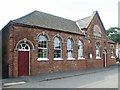
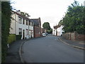
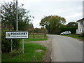
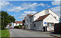
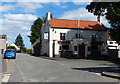
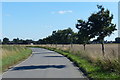
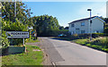
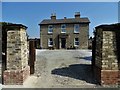
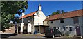
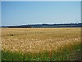
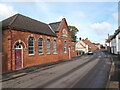
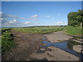
Photos of DN17 4RP
Area Information
DN17 4RP is a small, tightly knit residential cluster in England, covering just 2.2 hectares and home to 1535 residents. Its compact size means the area is characterised by a quiet, low-density living environment, with most properties being houses rather than flats. The population density of 34 people per square kilometre reflects a community that prioritises space and privacy. The median age of 47 suggests a stable demographic, with adults aged 30–64 forming the majority. This makes DN17 4RP a place where families and long-term residents predominate, contributing to a sense of continuity. Daily life is shaped by proximity to nearby amenities, including retail outlets and rail stations, which provide practical access to essentials. However, the area’s critical flood risk score highlights a key challenge for residents, requiring careful consideration of property location and insurance. Despite this, the low crime risk and good broadband connectivity make it an appealing option for those seeking a balanced lifestyle.
- Area Type
- Postcode
- Area Size
- 2.2 hectares
- Population
- 1535
- Population Density
- 34 people/km²
DN17 4RP is primarily an owner-occupied area, with 76% of residents living in homes they own. The accommodation type is predominantly houses, which is typical for a small, low-density postcode area. This suggests a market where property ownership is the norm, rather than rental tenancies. The limited size of the area—just 2.2 hectares—means the housing stock is finite, and buyers may find competition for available properties. The focus on houses rather than flats or apartments indicates a preference for private, spacious living. For those considering the area, the compact nature of DN17 4RP means proximity to amenities and transport is a key advantage, though buyers must weigh this against the critical flood risk.
House Prices in DN17 4RP
Showing 20 properties
| Address | Type | Beds | Baths | Last Sale Price | Last Sale Date | |
|---|---|---|---|---|---|---|
| Corner Cottage, High Street, Garthorpe, DN17 4RP | Terraced | 3 | 1 | £110,000 | Jun 2024 | |
| The Shambles, High Street, Garthorpe, DN17 4RP | Bungalow | 3 | 1 | £165,000 | Dec 2021 | |
| The White House, High Street, Garthorpe, DN17 4RP | house | - | - | £177,500 | Jul 2021 | |
| The Pines, High Street, Garthorpe, DN17 4RP | house | - | - | £225,000 | Nov 2020 | |
| The Cottage, High Street, Garthorpe, DN17 4RP | Cottage | 2 | 1 | £98,000 | Jul 2020 | |
| The Old Bakehouse, High Street, Garthorpe, DN17 4RP | Semi-detached | 2 | 1 | £166,000 | Mar 2015 | |
| The Haven, High Street, Garthorpe, DN17 4RP | Cottage | 6 | - | £100,000 | May 2008 | |
| Orchard View, High Street, Garthorpe, DN17 4RP | Cottage | 3 | - | £169,950 | Oct 2005 | |
| Roselea, High Street, Garthorpe, DN17 4RP | Bungalow | - | - | £134,000 | Sep 2004 | |
| Orewa, High Street, Garthorpe, DN17 4RP | Bungalow | - | - | £72,500 | Nov 2002 |
Energy Efficiency in DN17 4RP
The lifestyle in DN17 4RP is shaped by its proximity to essential amenities. Within practical reach, residents can access retail outlets such as Iceland Flixborough, Spar, and Co-op Winterton, which provide everyday shopping needs. The presence of multiple rail stations, including Althorpe and Broomfleet, adds convenience for travel and commuting. While the area does not have large parks or leisure facilities within its small boundaries, the surrounding region likely offers recreational opportunities. The compact nature of DN17 4RP means that daily errands and social activities are easily accessible, contributing to a low-maintenance lifestyle. However, the lack of detailed information on leisure options or cultural amenities means that residents may need to look beyond the immediate area for more extensive facilities.
Amenities
Schools
Residents of DN17 4RP have access to two primary schools within practical reach: Luddington & Garthorpe Primary and Eastoft Church of England Primary School. Both institutions hold an Ofsted rating of ‘good’, reflecting a standard of education that is above average. The presence of two primary schools suggests a well-served local community, particularly for families with young children. The mix of school types—while both are primary schools—ensures that parents have options for their children’s early education. However, the data does not provide information on secondary schools or higher education facilities in the immediate area, which may be a consideration for families planning for long-term schooling needs.
| Rank | School | Type | Entry gender | Ages |
|---|
Explore more schools in this area
Go to Schools tabDemographics
The community in DN17 4RP is predominantly composed of adults aged 30–64, with a median age of 47. This suggests a mature population, likely with established careers and families. Home ownership is high, at 76%, indicating a strong presence of long-term residents rather than transient renters. The accommodation type is overwhelmingly houses, which aligns with the area’s low density and residential character. The predominant ethnic group is White, reflecting a homogenous demographic profile. While this data does not provide specific information on deprivation levels, the high home ownership rate and stable age distribution suggest a community with relatively consistent economic stability. However, the absence of detailed diversity metrics means the full picture of social composition remains incomplete.
Household Size
Accommodation Type
Tenure
Ethnic Group
Religion
Household Composition
Age
Household Deprivation
NS-SEC
Explore more demographic insights in this area
Go to Demographics tabPlanning
Planning Constraints
- Flood RiskPremium
- Ramsar Wetland SitesPremium
- Area of Outstanding Natural BeautyPremium
- Protected Nature ReservePremium
- Protected WoodlandPremium