Area Overview for DN17 3SF
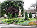
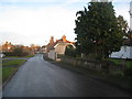
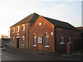
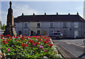
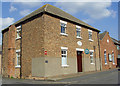
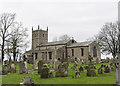
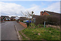
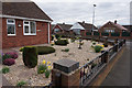
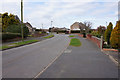
Photos of DN17 3SF

Area Information
DN17 3SF is a compact residential postcode in England, covering just 5.1 hectares and home to 1372 residents. Its small size means it is a tightly knit community, with a population density of 26,906 people per square kilometre. This area is defined by its modest scale, where daily life revolves around local amenities and a quiet, established residential character. With a median age of 47 and a majority of residents aged between 30 and 64, the community is stable and family-oriented. The area’s proximity to rail networks and strong broadband connectivity make it appealing for those seeking a balance between rural tranquillity and urban accessibility. While it lacks natural conservation designations, its low flood risk and below-average crime rates contribute to a sense of security. For buyers, DN17 3SF offers a rare blend of limited space and well-defined local services, ideal for those prioritising safety, simplicity, and ease of access to nearby towns.
- Area Type
- Postcode
- Area Size
- 5.1 hectares
- Population
- 1372
- Population Density
- 1667 people/km²
The property market in DN17 3SF is characterised by high home ownership (78%) and a predominance of houses. This indicates a market skewed towards owner-occupied properties rather than rentals, which is typical of smaller, established residential areas. The limited area size means the housing stock is constrained, with fewer new developments likely. For buyers, this suggests a focus on existing properties rather than speculative investment. The concentration of houses implies a preference for private, low-density living, which may appeal to those seeking space and security. However, the small footprint of the area means buyers may need to consider nearby postcode areas for more options. The high ownership rate also suggests a stable market with less turnover, making it a reliable choice for those prioritising long-term residency.
House Prices in DN17 3SF
Showing 22 properties
| Address | Type | Beds | Baths | Last Sale Price | Last Sale Date | |
|---|---|---|---|---|---|---|
| 9 Temperance Avenue, Messingham, DN17 3SF | Retail | 2 | 1 | £240,000 | Jun 2022 | |
| 1A Temperance Avenue, Messingham, DN17 3SF | Semi-detached | 3 | 1 | £155,146 | Mar 2021 | |
| 2 Temperance Avenue, Messingham, DN17 3SF | Detached | 3 | 2 | £127,000 | Jan 2018 | |
| 7 Temperance Avenue, Messingham, DN17 3SF | Bungalow | - | - | £180,000 | Jun 2017 | |
| 11 Temperance Avenue, Messingham, DN17 3SF | house | - | - | £210,000 | May 2010 | |
| 4 Temperance Avenue, Messingham, DN17 3SF | Semi-detached | - | - | £94,250 | May 2003 | |
| 8 Temperance Avenue, Messingham, DN17 3SF | Semi-detached | - | - | £68,000 | May 2002 | |
| 5 Temperance Avenue, Messingham, DN17 3SF | Detached | 4 | 3 | £64,950 | Aug 2000 | |
| 3 Temperance Avenue, Messingham, DN17 3SF | Semi-detached | - | - | £40,000 | Nov 1998 | |
| 1 Temperance Avenue, Messingham, DN17 3SF | Detached | 4 | 2 | £48,500 | Jun 1998 |
Energy Efficiency in DN17 3SF
Living in DN17 3SF offers access to essential retail and transport services within practical reach. The area includes five retail outlets, with notable names such as Lincolnshire Co-operative Co and Heron Riddings, providing everyday shopping convenience. Nearby rail stations—Scunthorpe, Kirton Lindsey, and Althorpe—connect residents to broader regional networks, enhancing mobility for work, leisure, or travel. While the area lacks detailed data on parks or leisure facilities, the presence of multiple retail points and rail links suggests a functional, community-focused lifestyle. The compact nature of the postcode means amenities are concentrated, reducing the need for long commutes. For residents, this balance of local services and transport options supports a practical, low-maintenance daily routine. The absence of expansive recreational spaces may be a consideration, but the area’s focus on accessibility and essential services caters to those prioritising convenience over sprawling amenities.
Amenities
Schools
| Rank | School | Type | Entry gender | Ages |
|---|
Explore more schools in this area
Go to Schools tabDemographics
The population of DN17 3SF is predominantly composed of adults aged 30 to 64, with a median age of 47. This suggests a mature, settled community with fewer young families or retirees. Home ownership is high, at 78%, indicating a strong presence of long-term residents. The accommodation is largely houses, reflecting a traditional, low-density housing stock. The predominant ethnic group is White, with no specific data provided on other demographics. The age profile and ownership rates imply a stable, low-turnover area where residents are likely to remain for extended periods. The absence of detailed diversity statistics means the community’s cultural composition is not fully defined, but the data highlights a focus on established households. The low population density, despite the small area, suggests a mix of single-family homes and possibly some smaller properties.
Household Size
Accommodation Type
Tenure
Ethnic Group
Religion
Household Composition
Age
Household Deprivation
NS-SEC
Explore more demographic insights in this area
Go to Demographics tabPlanning
Planning Constraints
- Flood RiskPremium
- Ramsar Wetland SitesPremium
- Area of Outstanding Natural BeautyPremium
- Protected Nature ReservePremium
- Protected WoodlandPremium