Area Overview for DN17 3RL
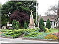
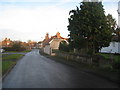
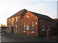
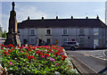
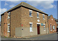
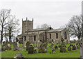
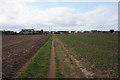
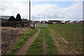
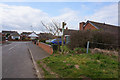
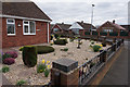
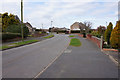
Photos of DN17 3RL

Area Information
DN17 3RL is a compact residential postcode in England, covering just 1.8 hectares and home to 1,372 residents. Its high population density of 75,394 people per square kilometre reflects its small, tightly knit nature. This area is defined by its proximity to key transport links and local amenities, making it a practical choice for those seeking a balance between convenience and community. The demographic profile suggests a mature population, with adults aged 30–64 forming the majority. Daily life here is likely characterised by a mix of local retail, rail access, and a low-risk environment for safety and planning constraints. While the area’s size is limited, its strategic placement near Scunthorpe and surrounding towns ensures connectivity to broader services. For buyers, DN17 3RL offers a snapshot of a stable, owner-occupied community with minimal environmental restrictions, though its small footprint means limited expansion potential. The broadband score of 100 ensures seamless digital connectivity, supporting remote work or online activities. This postcode is ideal for those prioritising practicality, safety, and proximity to essential services.
- Area Type
- Postcode
- Area Size
- 1.8 hectares
- Population
- 1372
- Population Density
- 1667 people/km²
The property market in DN17 3RL is dominated by owner-occupied homes, with 78% of residents living in their own properties. This high home ownership rate suggests a stable market with limited rental activity, which may appeal to buyers seeking long-term investment or a place to settle. The accommodation type is exclusively houses, indicating a lack of flats or apartments. This aligns with the area’s small size and residential character, where larger properties are likely the norm. For buyers, the limited number of homes available (given the 1.8-hectare footprint) means competition may be fierce, but the absence of planning constraints or protected sites could simplify property transactions. The focus on single-family homes also implies a preference for private, spacious living, which may suit families or those prioritising privacy. However, the area’s compact nature means buyers must consider proximity to nearby towns for additional amenities.
House Prices in DN17 3RL
Showing 23 properties
| Address | Type | Beds | Baths | Last Sale Price | Last Sale Date | |
|---|---|---|---|---|---|---|
| 12 Highgrove, Messingham, DN17 3RL | Detached | 4 | 2 | £360,000 | Oct 2025 | |
| 20 Highgrove, Messingham, DN17 3RL | Detached | 3 | 1 | £315,000 | Aug 2024 | |
| 23 Highgrove, Messingham, DN17 3RL | Bungalow | 3 | 2 | £240,000 | Mar 2024 | |
| 19 Highgrove, Messingham, DN17 3RL | house | - | - | £280,000 | Apr 2021 | |
| 10 Highgrove, Messingham, DN17 3RL | Detached | 4 | - | £232,000 | Jan 2020 | |
| 13 Highgrove, Messingham, DN17 3RL | Detached | 4 | - | £225,000 | Jun 2018 | |
| 15 Highgrove, Messingham, DN17 3RL | Bungalow | 3 | - | £197,000 | Nov 2011 | |
| 17 Highgrove, Messingham, DN17 3RL | Detached | - | - | £233,500 | Mar 2007 | |
| 2 Highgrove, Messingham, DN17 3RL | Detached | - | - | £94,000 | Jan 2002 | |
| 7 Highgrove, Messingham, DN17 3RL | Detached | - | - | £107,000 | Jul 2001 |
Energy Efficiency in DN17 3RL
The lifestyle in DN17 3RL is shaped by its proximity to essential amenities. Within practical reach are five retail outlets, including the Lincolnshire Co-operative Co at Heron Riddings, offering local shopping options. Three railway stations—Scunthorpe, Kirton Lindsey, and Althorpe—provide easy access to broader networks, supporting both daily commutes and weekend travel. While the area lacks large parks or leisure facilities, its small size means residents are likely close to nearby towns for more extensive amenities. The presence of multiple retail points and rail links suggests a convenient, community-focused lifestyle, with opportunities for local interaction and connectivity. For those valuing practicality over sprawling leisure options, DN17 3RL offers a compact, functional environment that prioritises accessibility and essential services.
Amenities
Schools
| Rank | School | Type | Entry gender | Ages |
|---|
Explore more schools in this area
Go to Schools tabDemographics
The community in DN17 3RL is predominantly composed of adults aged 30–64, with a median age of 47. This suggests a mature, established population, likely with long-term ties to the area. Home ownership is high at 78%, indicating a stable housing market where most residents live in their own homes. The accommodation type is primarily houses, which aligns with the area’s small size and residential focus. The predominant ethnic group is White, reflecting a homogenous demographic profile. While no specific data on deprivation is provided, the high home ownership and low crime risk (69/100) suggest a relatively affluent and secure environment. The absence of protected natural areas or planning constraints may contribute to a straightforward living experience, with fewer regulatory hurdles for property development or modification. This profile positions DN17 3RL as a community with strong local ties, minimal environmental restrictions, and a focus on traditional housing.
Household Size
Accommodation Type
Tenure
Ethnic Group
Religion
Household Composition
Age
Household Deprivation
NS-SEC
Explore more demographic insights in this area
Go to Demographics tabPlanning
Planning Constraints
- Flood RiskPremium
- Ramsar Wetland SitesPremium
- Area of Outstanding Natural BeautyPremium
- Protected Nature ReservePremium
- Protected WoodlandPremium