Area Overview for DN17 2QE
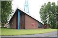
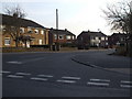
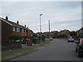
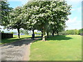
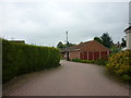
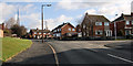
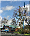
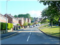
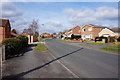
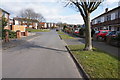
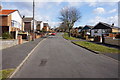
Photos of DN17 2QE

Area Information
DN17 2QE is a small, densely populated postcode area in England, covering 9880 square metres with a population of 1576 people, translating to a high density of 1403 residents per square kilometre. Situated within the Scunthorpe conurbation, this area retains pockets of rural farmland extending to the River Trent, blending urban proximity with semi-rural character. The village of Bottesford, nearby, has historical roots as a farming community, with features like the 1553 bronze bell and Fleming’s Bridge dating back to the 1620s. Daily life here is shaped by its compact size and connectivity to surrounding towns. While the area is small, it benefits from nearby railway stations and retail hubs, offering a balance of convenience and quiet living. The demographic profile suggests a mature community, with a median age of 47 and a strong presence of adults aged 30–64. This makes DN17 2QE appealing to those seeking a settled, low-maintenance lifestyle near essential services and transport links.
- Area Type
- Postcode
- Area Size
- 9880 m²
- Population
- 1576
- Population Density
- 1403 people/km²
The property market in DN17 2QE is dominated by owner-occupied homes, with 92% of properties owned outright. This high rate of home ownership suggests a community of long-term residents rather than a rental market. The accommodation type is predominantly houses, which is typical for smaller, rural or semi-rural areas. Given the area’s compact size and high population density, the housing stock is likely to be limited, with properties concentrated in a small cluster. For buyers, this means a niche market with limited availability, though the high home ownership rate may indicate strong demand from existing residents. The focus on houses rather than flats or apartments could appeal to those seeking more space or land. However, the small area and surrounding regions may have limited scope for new developments, making properties here potentially more valuable or sought after.
House Prices in DN17 2QE
Showing 22 properties
| Address | Type | Beds | Baths | Last Sale Price | Last Sale Date | |
|---|---|---|---|---|---|---|
| 5 South Ridge Crescent, Bottesford, DN17 2QE | Semi-detached | 3 | 1 | £177,500 | Feb 2025 | |
| 22 South Ridge Crescent, Bottesford, DN17 2QE | Detached | 4 | 1 | £165,000 | Oct 2020 | |
| 19 South Ridge Crescent, Bottesford, DN17 2QE | Semi-detached | 3 | 1 | £143,000 | Jun 2020 | |
| 8 South Ridge Crescent, Bottesford, DN17 2QE | house | 4 | 2 | £152,000 | Nov 2016 | |
| 12 South Ridge Crescent, Bottesford, DN17 2QE | house | - | - | £150,000 | Oct 2015 | |
| 9 South Ridge Crescent, Bottesford, DN17 2QE | Semi-detached | 3 | - | £132,000 | Oct 2015 | |
| 4 South Ridge Crescent, Bottesford, DN17 2QE | Semi-detached | 3 | 1 | £135,000 | Jun 2014 | |
| 15 South Ridge Crescent, Bottesford, DN17 2QE | house | - | - | £200,000 | Jun 2010 | |
| 1 South Ridge Crescent, Bottesford, DN17 2QE | Detached | - | - | £157,950 | Nov 2006 | |
| 18 South Ridge Crescent, Bottesford, DN17 2QE | Semi-detached | - | - | £55,000 | Nov 1999 |
Energy Efficiency in DN17 2QE
Residents of DN17 2QE have access to a range of nearby amenities, including five retail outlets such as Heron Riddings, Lincolnshire Co-operative Co, and Tesco Ashby, ensuring everyday shopping needs are met. The area’s proximity to three railway stations—Scunthorpe, Althorpe, and Kirton Lindsey—facilitates travel to urban centres for work, dining, or leisure. While the data does not specify parks or recreational facilities, the historical context of Bottesford suggests potential for green spaces, such as the Millennium Green. The presence of retail and transport options supports a convenient lifestyle, balancing local services with regional connectivity. The compact nature of the area means amenities are within practical reach, though the lack of detailed information on leisure facilities means their full extent remains unclear.
Amenities
Schools
| Rank | School | Type | Entry gender | Ages |
|---|
Explore more schools in this area
Go to Schools tabDemographics
The community in DN17 2QE is predominantly composed of adults aged 30–64, with a median age of 47. This suggests a mature population, likely with established careers and families. Home ownership is exceptionally high at 92%, indicating a stable, long-term resident base. The area is characterised by houses rather than flats, reflecting a preference for single-family dwellings. The predominant ethnic group is White, with no specific data provided on other demographics. The high home ownership rate and age profile imply a community focused on long-term residency rather than transient populations. This stability may contribute to a cohesive local environment, though the lack of diversity data means the full range of cultural or social dynamics remains unexplored. The low population density, despite the small area, suggests a mix of single-family homes and possibly some larger properties.
Household Size
Accommodation Type
Tenure
Ethnic Group
Religion
Household Composition
Age
Household Deprivation
NS-SEC
Explore more demographic insights in this area
Go to Demographics tabPlanning
Planning Constraints
- Flood RiskPremium
- Ramsar Wetland SitesPremium
- Area of Outstanding Natural BeautyPremium
- Protected Nature ReservePremium
- Protected WoodlandPremium