Area Overview for DN17 2QB
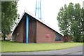
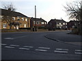
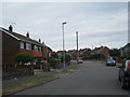
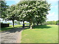
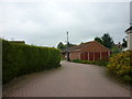
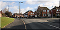
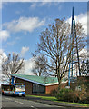
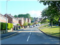
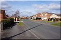
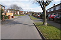
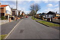
Photos of DN17 2QB

Area Information
Living in DN17 2QB means inhabiting a compact, densely populated residential cluster within the Scunthorpe conurbation, where rural farmland meets urban infrastructure. The area spans just 1.9 hectares, housing 1,576 people at a density of 1,403 per square kilometre. This small postcode area sits at the edge of Bottesford, a village with a history rooted in farming and medieval settlements. While its western reaches remain rural, the area is now integrated into the broader Scunthorpe economy. Daily life here is shaped by proximity to transport links and a mix of historical character and modern convenience. The village’s past as a Saxon-Danish-Norse settlement and its role in World War II, including the last British bombing in 1945, add layers of heritage. Residents benefit from nearby amenities and a community defined by long-term residents, with 92% owning their homes. The area’s compact size means a tight-knit feel, though its limited space also reflects the challenges of growth in a constrained environment.
- Area Type
- Postcode
- Area Size
- 1.9 hectares
- Population
- 1576
- Population Density
- 1403 people/km²
The property market in DN17 2QB is overwhelmingly owner-occupied, with 92% of homes owned by residents rather than rented. This contrasts with areas where rental markets dominate, indicating a community of long-term residents invested in their homes. The accommodation type is predominantly houses, not flats, which is typical of semi-rural or suburban areas. Given the postcode’s small size (1.9 hectares) and high population density, the housing stock is likely to be tightly packed, with limited scope for new developments. Buyers should consider that the area’s compact nature means properties are likely to be in established, older stock rather than new builds. The high home ownership rate also suggests a stable market with little turnover, making it a place for those seeking security rather than speculative investment.
House Prices in DN17 2QB
Showing 20 properties
| Address | Type | Beds | Baths | Last Sale Price | Last Sale Date | |
|---|---|---|---|---|---|---|
| 14 Brankwell Crescent, Bottesford, DN17 2QB | Detached | 3 | 2 | £232,000 | Aug 2023 | |
| 8 Brankwell Crescent, Bottesford, DN17 2QB | Retail | 3 | 1 | £185,000 | Apr 2022 | |
| 16 Brankwell Crescent, Bottesford, DN17 2QB | Detached | 4 | 2 | £172,000 | Mar 2016 | |
| 6 Brankwell Crescent, Bottesford, DN17 2QB | Semi-detached | - | - | £154,000 | Mar 2016 | |
| 36 Brankwell Crescent, Bottesford, DN17 2QB | Semi-detached | 3 | 1 | £110,000 | Oct 2015 | |
| 38 Brankwell Crescent, Bottesford, DN17 2QB | Semi-detached | - | - | £116,000 | Feb 2009 | |
| 22 Brankwell Crescent, Bottesford, DN17 2QB | house | - | - | £160,000 | Jul 2008 | |
| 26 Brankwell Crescent, Bottesford, DN17 2QB | house | 3 | - | £155,000 | Jul 2008 | |
| 4 Brankwell Crescent, Bottesford, DN17 2QB | Semi-detached | 3 | 1 | £128,500 | Oct 2005 | |
| 40 Brankwell Crescent, Bottesford, DN17 2QB | Semi-detached | - | - | £52,000 | Aug 2002 |
Energy Efficiency in DN17 2QB
Residents of DN17 2QB have access to a range of local amenities within practical reach. Retail options include Heron Riddings, Lincolnshire Co-operative Co, and Tesco Ashby, offering everyday shopping needs. The three nearby railway stations—Scunthorpe, Althorpe, and Kirton Lindsey—provide connections to larger towns and cities, enhancing mobility. The area’s historical character is complemented by modern conveniences, such as the Millennium Green and Bottesford water mill (now a private home). The parish church, Fleming’s Bridge, and the Duke of Rutland’s Hospital add cultural and historical depth. While the area’s compact size means limited green spaces, the proximity to the River Trent and rural farmland offers opportunities for outdoor activities. The mix of heritage sites and practical amenities creates a lifestyle that balances tradition with accessibility.
Amenities
Schools
| Rank | School | Type | Entry gender | Ages |
|---|
Explore more schools in this area
Go to Schools tabDemographics
DN17 2QB’s population of 1,576 is predominantly composed of adults aged 30–64, with a median age of 47. This suggests a mature, stable community with a strong presence of middle-aged households. Home ownership is exceptionally high at 92%, indicating a preference for long-term residency over rental properties. The area is largely composed of houses, not flats, reflecting a suburban or semi-rural housing stock. The predominant ethnic group is White, aligning with broader trends in North Lincolnshire. The high home ownership rate and age profile suggest a community focused on stability, with fewer transient residents. The population density of 1,403 per square kilometre implies a compact, possibly multi-generational living environment. While no specific deprivation data is provided, the high ownership and low crime risk (86/100) suggest a relatively secure, self-sufficient neighbourhood.
Household Size
Accommodation Type
Tenure
Ethnic Group
Religion
Household Composition
Age
Household Deprivation
NS-SEC
Explore more demographic insights in this area
Go to Demographics tabPlanning
Planning Constraints
- Flood RiskPremium
- Ramsar Wetland SitesPremium
- Area of Outstanding Natural BeautyPremium
- Protected Nature ReservePremium
- Protected WoodlandPremium