Area Overview for DN17 2JG
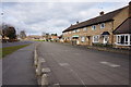
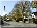
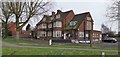
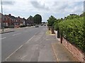
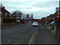
Photos of DN17 2JG


Area Information
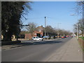
DN17 2JG is a compact residential postcode area in Scunthorpe, North Lincolnshire, covering just 1.6 hectares and home to 1,495 residents. Its small size means the community is tightly knit, with a population density of 94,782 people per square kilometre, reflecting a high concentration of housing in a limited space. The area falls within the Brumby Ward, part of the Scunthorpe parliamentary constituency. Daily life here is shaped by proximity to local amenities and transport links, with a mix of retail, dining, and rail options nearby. The median age of 47 suggests a mature population, with the majority of residents aged 30–64. While the area lacks large-scale infrastructure, its accessibility to Scunthorpe’s broader services makes it a practical choice for those seeking a quieter, residential setting without sacrificing connectivity. The absence of protected natural areas or planning constraints means development is not restricted, though the high crime risk is a notable consideration for prospective buyers.
- Area Type
- Postcode
- Area Size
- 1.6 hectares
- Population
- 1495
- Population Density
- 2325 people/km²
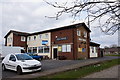
DN17 2JG is a small, residential area where 46% of homes are owner-occupied, suggesting a moderate balance between private ownership and rental properties. The accommodation type is predominantly houses, which may appeal to families seeking more space than flats. Given the area’s limited size—just 1.6 hectares—property availability is constrained, and the market likely reflects local demand rather than broader regional trends. The high population density indicates a need for efficient use of space, potentially limiting the availability of larger homes or new developments. Buyers should consider the area’s compact nature and the fact that it is not part of a larger urban sprawl, which may affect property value stability and future investment potential.
House Prices in DN17 2JG
Showing 42 properties
| Address | Type | Beds | Baths | Last Sale Price | Last Sale Date | |
|---|---|---|---|---|---|---|
| 7 Ormsby Road, Scunthorpe, DN17 2JG | house | 3 | 1 | £94,730 | Sep 2023 | |
| 18 Ormsby Road, Scunthorpe, DN17 2JG | Terraced | 3 | 1 | £119,000 | Apr 2023 | |
| 22 Ormsby Road, Scunthorpe, DN17 2JG | house | - | - | £100,000 | Apr 2022 | |
| 33 Ormsby Road, Scunthorpe, DN17 2JG | Terraced | 3 | 1 | £84,000 | Jan 2020 | |
| 9 Ormsby Road, Scunthorpe, DN17 2JG | Terraced | 3 | 1 | £62,500 | Aug 2017 | |
| 34 Ormsby Road, Scunthorpe, DN17 2JG | Terraced | 3 | - | £43,000 | Oct 2012 | |
| 3 Ormsby Road, Scunthorpe, DN17 2JG | house | 3 | - | £61,000 | Aug 2012 | |
| 6 Ormsby Road, Scunthorpe, DN17 2JG | house | 3 | 1 | £57,500 | Oct 2010 | |
| 43 Ormsby Road, Scunthorpe, DN17 2JG | Terraced | - | - | £48,000 | May 2007 | |
| 24 Ormsby Road, Scunthorpe, DN17 2JG | house | - | - | £109,950 | Dec 2006 |
Energy Efficiency in DN17 2JG
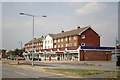
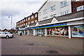
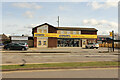
The lifestyle in DN17 2JG is shaped by its proximity to retail, dining, and transport hubs. Within practical reach are five retail venues, including Asda Scunthorpe and Lincolnshire Co-operative Co, providing access to groceries, clothing, and household goods. The three nearby railway stations—Scunthorpe, Althorpe, and Kirton Lindsey—offer convenient travel options to urban centres and beyond. While the area itself is small, its integration with Scunthorpe’s broader infrastructure ensures residents can access a wider range of services. The compact nature of DN17 2JG means amenities are closely clustered, fostering a sense of convenience and community. However, the lack of dedicated leisure or recreational spaces within the postcode suggests that outdoor activities may require travel to nearby parks or open areas.
Amenities
Schools
Nearby schools include Enderby Road Infant School, a primary school with a ‘good’ Ofsted rating, and South Leys Business and Enterprise College, also a primary school. The presence of two primary schools within practical reach suggests the area is well-suited for families with young children. Enderby Road Infant School’s positive rating indicates a reliable foundation for early education, though no data is available on the college’s performance. The absence of secondary schools in the immediate vicinity may require families to commute to Scunthorpe for further education, a factor to consider when assessing long-term needs. The mix of school types reflects a focus on primary education, which aligns with the area’s demographic profile of older residents and families.
| Rank | School | Type | Entry gender | Ages |
|---|
Explore more schools in this area
Go to Schools tabDemographics
The population of DN17 2JG is predominantly adults aged 30–64, with a median age of 47. This suggests a community of established professionals and families, rather than a younger demographic. Home ownership rates stand at 46%, indicating a mix of owner-occupied and rental properties, though the exact proportion of renters is not specified. The accommodation type is primarily houses, reflecting a low-rise, residential character. The predominant ethnic group is White, with no data provided on other demographics. The high population density—94,782 people per square kilometre—implies a compact, possibly multi-generational living environment. While this density may support local services and social interaction, it also raises questions about the area’s capacity for future growth or changes in housing demand.
Household Size
Accommodation Type
Tenure
Ethnic Group
Religion
Household Composition
Age
Household Deprivation
NS-SEC
Explore more demographic insights in this area
Go to Demographics tabPlanning
Planning Constraints
- Flood RiskPremium
- Ramsar Wetland SitesPremium
- Area of Outstanding Natural BeautyPremium
- Protected Nature ReservePremium
- Protected WoodlandPremium