Area Overview for DN14 8AQ
Photos of DN14 8AQ
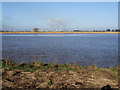
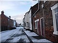
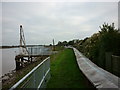


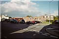
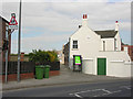
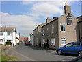
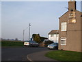
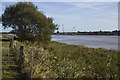
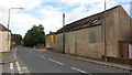
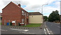
47 photos from this area
Area Information
Key information about the DN14 8AQ including its size, population, and administrative classification.
- Area Type
- Postcode
- Area Size
- 8.2 hectares
- Population
- 1867
- Population Density
- 37 people/km²
House Prices in DN14 8AQ
25
Properties
£116,211
Average Sold Price
£37,500
Lowest Price
£210,000
Highest Price
Showing 25 properties
| Address | Type | Beds | Baths | Last Sale Price | Last Sale Date | |
|---|---|---|---|---|---|---|
| 59 High Street, Swinefleet, DN14 8AQ | house | - | - | £120,000 | Sep 2021 | |
| 77 High Street, Swinefleet, DN14 8AQ | house | 3 | 2 | £170,000 | Aug 2021 | |
| 60 High Street, Swinefleet, DN14 8AQ | house | 2 | 2 | £110,000 | Nov 2020 | |
| 58 High Street, Swinefleet, DN14 8AQ | house | 3 | 1 | £113,500 | Nov 2020 | |
| 79 High Street, Swinefleet, DN14 8AQ | Semi-detached | 3 | 2 | £170,000 | May 2020 | |
| Riverside Cottage, High Street, Swinefleet, DN14 8AQ | Detached | 2 | 1 | £114,500 | May 2019 | |
| 36 High Street, Swinefleet, DN14 8AQ | house | 4 | - | £52,500 | Nov 2014 | |
| 57 High Street, Swinefleet, DN14 8AQ | house | 3 | - | £70,000 | Jul 2011 | |
| 54 High Street, Swinefleet, DN14 8AQ | Detached | - | - | £210,000 | Apr 2008 | |
| 52A High Street, Swinefleet, DN14 8AQ | Flat | - | - | £154,950 | Dec 2007 |
Page 1 of 3
Energy Efficiency in DN14 8AQ
Amenities
Schools
| Rank | School | Type | Entry gender | Ages |
|---|
Explore more schools in this area
Go to Schools tabDemographics
Household Size
Two person
most common
Accommodation Type
Houses
most common
Tenure
83
majority
Ethnic Group
White
most common
Religion
N/A
most common
Household Composition
N/A
most common
Age
47
median
Adults (30-64 years)
most common
Household Deprivation
N/A
with no deprivation
NS-SEC
37
in Lower managerial occupations
Explore more demographic insights in this area
Go to Demographics tabPlanning
Planning Constraints
- Flood RiskPremium
- Ramsar Wetland SitesPremium
- Area of Outstanding Natural BeautyPremium
- Protected Nature ReservePremium
- Protected WoodlandPremium