Area Overview for DL9 4PB
Photos of DL9 4PB
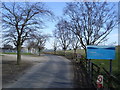
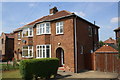
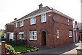
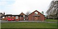
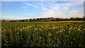
13 photos from this area
Area Information
Key information about the DL9 4PB including its size, population, and administrative classification.
- Area Type
- Postcode
- Area Size
- 39.3 hectares
- Population
- 1800
- Population Density
- 732 people/km²
House Prices in DL9 4PB
13
Properties
£201,357
Average Sold Price
£92,500
Lowest Price
£300,000
Highest Price
Showing 13 properties
| Address | Type | Beds | Baths | Last Sale Price | Last Sale Date | |
|---|---|---|---|---|---|---|
| 110 Colburn Lane, Colburn, DL9 4PB | Bungalow | 3 | 2 | £300,000 | Oct 2022 | |
| Clarissa, Colburn Lane, Colburn, DL9 4PB | Bungalow | - | - | £250,000 | Feb 2020 | |
| 104 Colburn Lane, Colburn, DL9 4PB | Detached | - | - | £200,000 | Mar 2017 | |
| 108 Colburn Lane, Colburn, DL9 4PB | Bungalow | 2 | 1 | £175,000 | Nov 2015 | |
| 106 Colburn Lane, Colburn, DL9 4PB | Bungalow | - | - | £182,000 | Sep 2015 | |
| 112 Colburn Lane, Colburn, DL9 4PB | Bungalow | - | - | £210,000 | Mar 2007 | |
| Swale View, 120 Colburn Lane, Colburn, DL9 4PB | Detached | - | - | £92,500 | Aug 1997 | |
| The Chippings, 104A Colburn Lane, Colburn, DL9 4PB | Bungalow | 2 | 1 | - | - | |
| 118 Colburn Lane, Colburn, DL9 4PB | Detached | - | - | - | - | |
| 116 Colburn Lane, Colburn, DL9 4PB | Detached | - | - | - | - |
Page 1 of 2
Energy Efficiency in DL9 4PB
Amenities
Schools
| Rank | School | Type | Entry gender | Ages |
|---|
Explore more schools in this area
Go to Schools tabDemographics
Household Size
Family (3-5 people)
most common
Accommodation Type
Houses
most common
Tenure
68
majority
Ethnic Group
White
most common
Religion
N/A
most common
Household Composition
N/A
most common
Age
47
median
Adults (30-64 years)
most common
Household Deprivation
N/A
with no deprivation
NS-SEC
25
in Lower managerial occupations
Explore more demographic insights in this area
Go to Demographics tabPlanning
Planning Constraints
- Flood RiskPremium
- Ramsar Wetland SitesPremium
- Area of Outstanding Natural BeautyPremium
- Protected Nature ReservePremium
- Protected WoodlandPremium