Area Overview for BD9 6QS
Photos of BD9 6QS
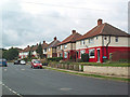
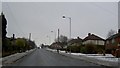
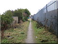
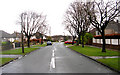
94 photos from this area
Area Information
Key information about the BD9 6QS including its size, population, and administrative classification.
- Area Type
- Postcode
- Area Size
- 2.1 hectares
- Population
- 2231
- Population Density
- 2134 people/km²
House Prices in BD9 6QS
40
Properties
£127,468
Average Sold Price
£51,500
Lowest Price
£200,000
Highest Price
Showing 40 properties
| Address | Type | Beds | Baths | Last Sale Price | Last Sale Date | |
|---|---|---|---|---|---|---|
| 76 Brantwood Drive, Bradford, BD9 6QS | Semi-detached | 3 | 2 | £190,000 | Dec 2023 | |
| 74 Brantwood Drive, Bradford, BD9 6QS | house | - | - | £157,000 | Jun 2023 | |
| 12 Brantwood Drive, Bradford, BD9 6QS | house | - | - | £154,000 | Feb 2023 | |
| 46 Brantwood Drive, Bradford, BD9 6QS | Bungalow | - | - | £135,000 | Aug 2022 | |
| 64 Brantwood Drive, Bradford, BD9 6QS | Semi-detached | 3 | 1 | £130,000 | Jan 2022 | |
| 72 Brantwood Drive, Bradford, BD9 6QS | Semi-detached | 3 | 1 | £158,000 | Nov 2021 | |
| 54 Brantwood Drive, Bradford, BD9 6QS | house | - | - | £125,000 | Jul 2021 | |
| 50 Brantwood Drive, Bradford, BD9 6QS | house | - | - | £118,000 | Jul 2021 | |
| 40 Brantwood Drive, Bradford, BD9 6QS | Semi-detached | 5 | 1 | £200,000 | Mar 2021 | |
| 32 Brantwood Drive, Bradford, BD9 6QS | Semi-detached | 4 | 1 | £168,000 | Mar 2021 |
Page 1 of 4
Energy Efficiency in BD9 6QS
Amenities
Schools
| Rank | School | Type | Entry gender | Ages |
|---|
Explore more schools in this area
Go to Schools tabDemographics
Household Size
Family (3-5 people)
most common
Accommodation Type
Houses
most common
Tenure
74
majority
Ethnic Group
asian_total
most common
Religion
N/A
most common
Household Composition
N/A
most common
Age
22
median
Adults (30-64 years)
most common
Household Deprivation
N/A
with no deprivation
NS-SEC
18
in Lower managerial occupations
Explore more demographic insights in this area
Go to Demographics tabPlanning
Planning Constraints
- Flood RiskPremium
- Ramsar Wetland SitesPremium
- Area of Outstanding Natural BeautyPremium
- Protected Nature ReservePremium
- Protected WoodlandPremium